
Page 50: of Marine Technology Magazine (March 2019)
Oceanographic Instrumentation: Measurement, Process & Analysis
Read this page in Pdf, Flash or Html5 edition of March 2019 Marine Technology Magazine
 49
49
 51
51
Image: Sonardyne
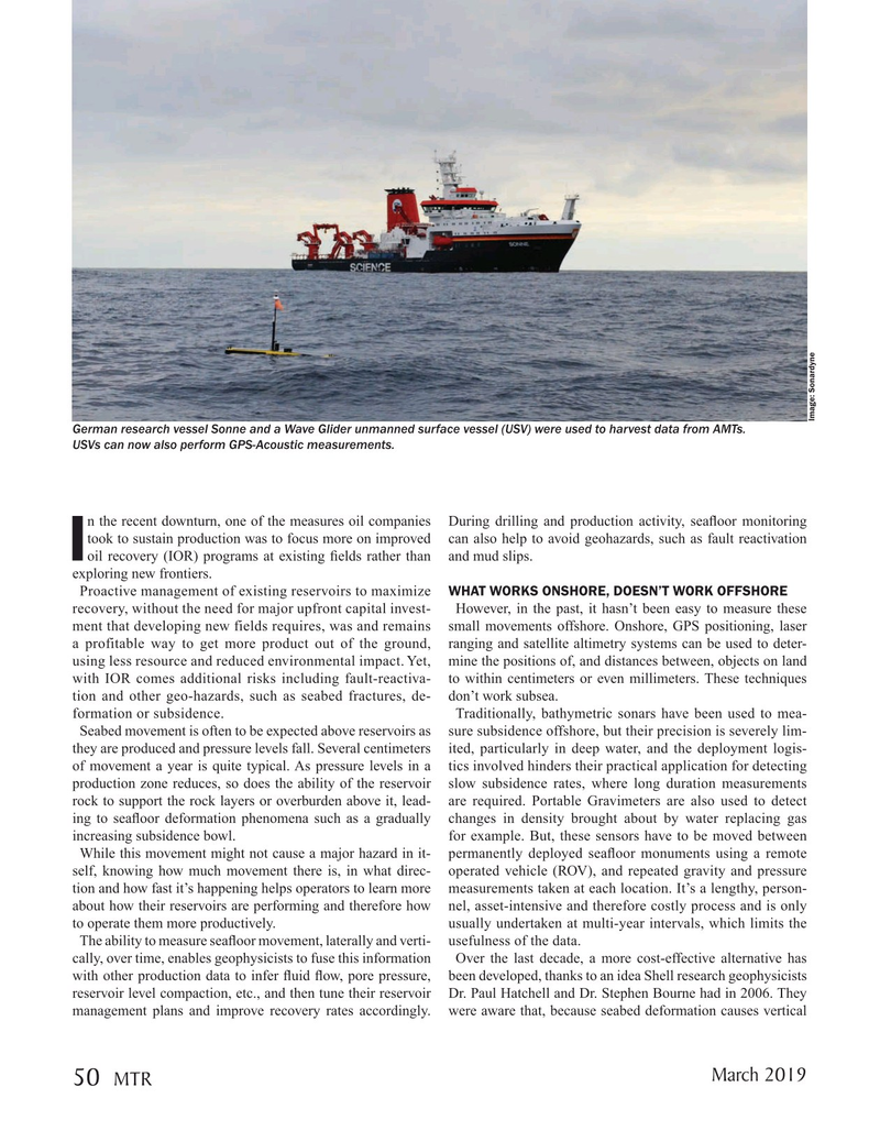
German research vessel Sonne and a Wave Glider unmanned surface vessel (USV) were used to harvest data from AMTs.
USVs can now also perform GPS-Acoustic measurements.
n the recent downturn, one of the measures oil companies During drilling and production activity, sea? oor monitoring took to sustain production was to focus more on improved can also help to avoid geohazards, such as fault reactivation
Ioil recovery (IOR) programs at existing ? elds rather than and mud slips.
exploring new frontiers.
Proactive management of existing reservoirs to maximize WHAT WORKS ONSHORE, DOESN’T WORK OFFSHORE recovery, without the need for major upfront capital invest- However, in the past, it hasn’t been easy to measure these ment that developing new fields requires, was and remains small movements offshore. Onshore, GPS positioning, laser a profitable way to get more product out of the ground, ranging and satellite altimetry systems can be used to deter- using less resource and reduced environmental impact. Yet, mine the positions of, and distances between, objects on land with IOR comes additional risks including fault-reactiva- to within centimeters or even millimeters. These techniques tion and other geo-hazards, such as seabed fractures, de- don’t work subsea.
formation or subsidence. Traditionally, bathymetric sonars have been used to mea-
Seabed movement is often to be expected above reservoirs as sure subsidence offshore, but their precision is severely lim- they are produced and pressure levels fall. Several centimeters ited, particularly in deep water, and the deployment logis- of movement a year is quite typical. As pressure levels in a tics involved hinders their practical application for detecting production zone reduces, so does the ability of the reservoir slow subsidence rates, where long duration measurements rock to support the rock layers or overburden above it, lead- are required. Portable Gravimeters are also used to detect ing to sea? oor deformation phenomena such as a gradually changes in density brought about by water replacing gas increasing subsidence bowl. for example. But, these sensors have to be moved between
While this movement might not cause a major hazard in it- permanently deployed sea? oor monuments using a remote self, knowing how much movement there is, in what direc- operated vehicle (ROV), and repeated gravity and pressure tion and how fast it’s happening helps operators to learn more measurements taken at each location. It’s a lengthy, person- about how their reservoirs are performing and therefore how nel, asset-intensive and therefore costly process and is only to operate them more productively. usually undertaken at multi-year intervals, which limits the
The ability to measure sea? oor movement, laterally and verti- usefulness of the data.
cally, over time, enables geophysicists to fuse this information Over the last decade, a more cost-effective alternative has with other production data to infer ? uid ? ow, pore pressure, been developed, thanks to an idea Shell research geophysicists reservoir level compaction, etc., and then tune their reservoir Dr. Paul Hatchell and Dr. Stephen Bourne had in 2006. They management plans and improve recovery rates accordingly. were aware that, because seabed deformation causes vertical
March 2019 50
MTR
MTR #2 (50-65).indd 50 3/11/2019 3:30:14 PM