Page 52: of Marine Technology Magazine (June 2019)
Hydrographic Survey: Single & Multibeam Sonar
Read this page in Pdf, Flash or Html5 edition of June 2019 Marine Technology Magazine
 51
51
 53
53
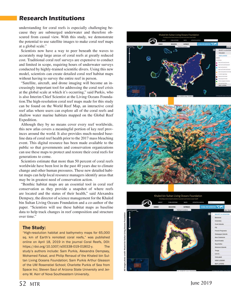
Research Institutions understanding for coral reefs is especially challenging be- cause they are submerged underwater and therefore ob- scured from casual view. With this study, we demonstrate the potential to use satellite images to make coral reef maps at a global scale.”
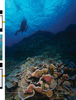
Scientists now have a way to peer beneath the waves to accurately map large areas of coral reefs at greatly reduced cost. Traditional coral reef surveys are expensive to conduct and limited in scope, requiring hours of underwater surveys conducted by highly-trained scienti? c divers. Using this new model, scientists can create detailed coral reef habitat maps without having to survey the entire reef in person.
“Satellite, aircraft, and drone imaging will become an in- creasingly important tool for addressing the coral reef crisis at the global scale at which it’s occurring,” said Purkis, who is also Interim Chief Scientist at the Living Oceans Founda- tion.The high-resolution coral reef maps made for this study can be found on the World Reef Map, an interactive coral reef atlas where users can explore all of the coral reefs and shallow water marine habitats mapped on the Global Reef
Expedition.
Although they by no means cover every reef worldwide, this new atlas covers a meaningful portion of key reef prov- inces around the world. It also provides much-needed base- line data of coral reef health prior to the 2017 mass bleaching event. This digital resource has been made available to the public so that governments and conservation organizations can use these maps to protect and restore their coral reefs for generations to come.
Scientists estimate that more than 50 percent of coral reefs worldwide have been lost in the past 40 years due to climate change and other human pressures. These new detailed habi- tat maps can help local resource managers identify areas that may be in greatest need of conservation action. “Benthic habitat maps are an essential tool in coral reef conservation as they provide a snapshot of where reefs are located and the status of their health,” said Alexandra
Dempsey, the director of science management for the Khaled bin Sultan Living Oceans Foundation and a co-author of the paper. “Scientists will use these habitat maps as baseline data to help track changes in reef composition and structure over time.”
The Study: “High-resolution habitat and bathymetry maps for 65,000 sq. km of Earth’s remotest coral reefs,” was published online on April 18, 2019 in the journal Coral Reefs, DOI: https://doi.org/10.1007/s00338-019-01802-y. The study’s authors include: Sam Purkis, Alexandra Dempsey,
Mohamed Faisal, and Philip Renaud of the Khaled bin Sul- tan Living Oceans Foundation; Sam Purkis Arthur Gleason of the UM Rosenstiel School; Charlotte Purkis of Sea from
Space Inc; Steven Saul of Arizona State University and Jer-
All images photo credit: Khaled bin Sultan Living Oceans Foundation emy M. Kerr of Nova Southeastern University.
June 2019 52
MTR
MTR #5 (50-63).indd 52 5/28/2019 9:48:07 AM