
Page 52: of Marine Technology Magazine (July 2021)
Autonomous Vehicle Operations
Read this page in Pdf, Flash or Html5 edition of July 2021 Marine Technology Magazine
 51
51
 53
53
TECH FEATURE BEACONS
NOVATECH iBCN
Satellite Beacons
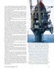
Tracking and locating assets up to full ocean depth he water is unpredictable. Maybe you are an ocean- in the world. The satellite beacons can be used with scienti? c ographer, with a sub-surface mooring that you need equipment, remote or autonomous vehicles, even cabling. How- to keep track of. Maybe you are in the oil and gas in- ever, they are particularly useful in the oil and gas industry.
dustry, with remote and autonomous vehicles work- “Most often, they are going on working class ROVs, which are ing at icy depths. Maybe you have one vessel. Maybe huge, remotely-operated vehicles, which can be worth millions
T you have an entire ? eet. of dollars. These machines are going thousands of meters deep
But what do you do when the unpredictable suddenly hap- in the ocean for pipeline inspection or to perform repairs on sub- pens? When a mooring breaks free unexpectedly, from ? shing surface platforms, and those umbilical lines can get severed, or trawling or simply environmental factors that you cannot which cuts out communications,” Aalders says. “It can take control? How do you recover, and move forward? days, sometimes months, for that vehicle to actually surface.”
For many experienced mariners, the only answer is a Met- But with a satellite beacon, you will know when a line has been
Ocean Telematics NOVATECH location and recovery assist severed, and when the RV comes up again, there is no guessing beacons. “It gives you that peace of mind,” says MetOcean where it might be. “There is potential for the oil and gas ? elds
Global Account Manager Evan Aalders. “Once you go to re- to use these beacons on instruments that they may never have cover the asset, either planned or unexpectedly, that beacon thought about, to aid in recovery or act as an insurance policy.” will sit high and proud at the ocean surface, turning on to pro- Companies, like BW Offshore, are ? nding innovative uses vide a means of recovery.” for the satellite beacons, utilizing the Iridium technology to its
The MetOcean Telematics NOVATECH beacons are de- fullest. By attaching beacons to pipeline cabling, BW Offshore signed to last in the harshest of ocean environments, and has been able to isolate speci? c sections of their sub-surface come in what Aalders describes as three families, depending work without having to do physical inspections. “Tradition- on need. For line-of-sight coverage, ? ashers are a high-pow- ally, you would only know there’s been a break when you saw ered visual aid. Used at either the surface level, or attached to the cable come to the surface with a ? oat,” Aalders says. “This submersible equipment, these beacons are especially helpful is basically giving them a real-time identi? cation about which in dark or stormy conditions. Next up, the radio beacons can beacon has pinged, and at which depth, so they can start work- transmit up to ? ve nautical miles, sending out an RF pulse on ing immediately to plan repair and recovery operations.” a speci? c frequency. For the most precise location and recov- All NOVATECH beacons are rated to 7,500 meters in depth, ery services, the satellite beacons are unparalleled. With GPS with the In? nity series able to sink 12,000 meters (developed mapping and bi-directional communication, the user is not for James Cameron’s Challenger Deep mission, exploring the required to be on-site. Instead, they will receive an email noti- Mariana’s Trench). While the ratings are impressive, what it ? cation when one of their beacons is activated, with a precise translates to is time saved. “Iridium was a real game changer,” location and consistent updates that they can control. “This Aalders says, in part because of the bi-directional communica- really is about high-value asset recovery,” Aalders says. tions. “We can actually set internal geo-fences so if the device
This is where, as Aalders explains, a global satellite network goes into a certain area, you will get an alert. And you have comes into play. Relying on Iridium technology, MetOcean the ability to send a message back to the beacon, to adjust the uses 60 low-orbit satellites to provide full coverage, anywhere reporting frequency.” If the beacon is pinging frequently, you 52 July/August 2021
MTR #5 (50-63).indd 52 7/30/2021 9:32:39 AM