Page 56: of Marine Technology Magazine (November 2021)
Ocean Observation: Gliders, Buoys & Sub-Surface Networks
Read this page in Pdf, Flash or Html5 edition of November 2021 Marine Technology Magazine
Tech File
Innovative new products, technologies and concepts
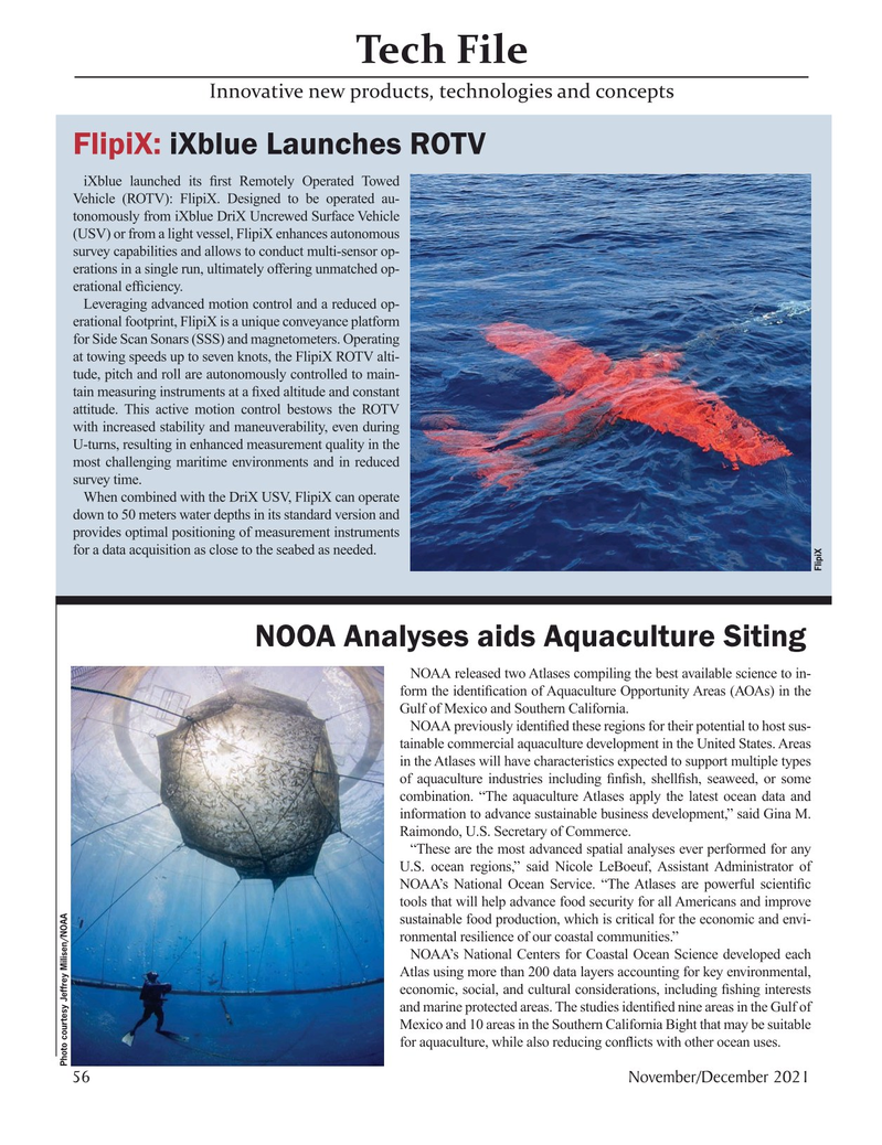
FlipiX: iXblue Launches ROTV iXblue launched its ? rst Remotely Operated Towed
Vehicle (ROTV): FlipiX. Designed to be operated au- tonomously from iXblue DriX Uncrewed Surface Vehicle (USV) or from a light vessel, FlipiX enhances autonomous survey capabilities and allows to conduct multi-sensor op- erations in a single run, ultimately offering unmatched op- erational ef? ciency.
Leveraging advanced motion control and a reduced op- erational footprint, FlipiX is a unique conveyance platform for Side Scan Sonars (SSS) and magnetometers. Operating at towing speeds up to seven knots, the FlipiX ROTV alti- tude, pitch and roll are autonomously controlled to main- tain measuring instruments at a ? xed altitude and constant attitude. This active motion control bestows the ROTV with increased stability and maneuverability, even during
U-turns, resulting in enhanced measurement quality in the most challenging maritime environments and in reduced survey time.
When combined with the DriX USV, FlipiX can operate down to 50 meters water depths in its standard version and provides optimal positioning of measurement instruments for a data acquisition as close to the seabed as needed.
FlipiX
NOOA Analyses aids Aquaculture Siting
NOAA released two Atlases compiling the best available science to in- form the identi? cation of Aquaculture Opportunity Areas (AOAs) in the
Gulf of Mexico and Southern California.
NOAA previously identi? ed these regions for their potential to host sus- tainable commercial aquaculture development in the United States. Areas in the Atlases will have characteristics expected to support multiple types of aquaculture industries including ? n? sh, shell? sh, seaweed, or some combination. “The aquaculture Atlases apply the latest ocean data and information to advance sustainable business development,” said Gina M.
Raimondo, U.S. Secretary of Commerce. “These are the most advanced spatial analyses ever performed for any
U.S. ocean regions,” said Nicole LeBoeuf, Assistant Administrator of
NOAA’s National Ocean Service. “The Atlases are powerful scienti? c tools that will help advance food security for all Americans and improve sustainable food production, which is critical for the economic and envi- ronmental resilience of our coastal communities.”
NOAA’s National Centers for Coastal Ocean Science developed each
Atlas using more than 200 data layers accounting for key environmental, economic, social, and cultural considerations, including ? shing interests and marine protected areas. The studies identi? ed nine areas in the Gulf of
Mexico and 10 areas in the Southern California Bight that may be suitable for aquaculture, while also reducing con? icts with other ocean uses.
Photo courtesy Jeffrey Milisen/NOAA 56 November/December 2021
MTR #8 (50-63).indd 56 11/24/2021 8:55:07 AM

 55
55

 57
57
