Page 26: of Marine Technology Magazine (July 2022)
Read this page in Pdf, Flash or Html5 edition of July 2022 Marine Technology Magazine
ROVs & Hybrids using Google Earth to search, view and navigate ocean map- ping data and related information, Childress explained.
FIN-TASTIC
As companies like Terradepth seek to better understand
Earth’s oceans, others are trying to actively ? x problems decades in the making. Plastic pollution, in all its complexi- ties and unknown impacts, remains a vexing problem. While governments and other organizations around the world have begun to limit plastic production, consumption and improper
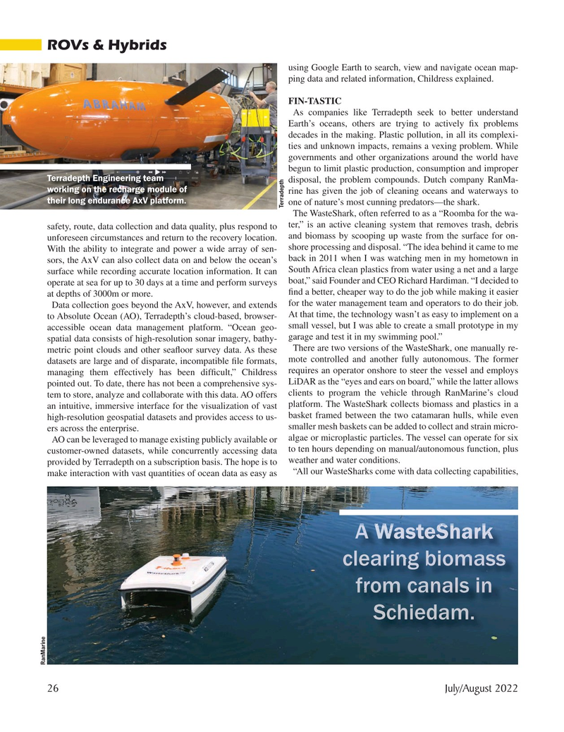
Terradepth Engineering team disposal, the problem compounds. Dutch company RanMa- working on the recharge module of rine has given the job of cleaning oceans and waterways to their long endurance AxV platform.
one of nature’s most cunning predators—the shark.
Terradepth
The WasteShark, often referred to as a “Roomba for the wa- safety, route, data collection and data quality, plus respond to ter,” is an active cleaning system that removes trash, debris unforeseen circumstances and return to the recovery location. and biomass by scooping up waste from the surface for on- shore processing and disposal. “The idea behind it came to me
With the ability to integrate and power a wide array of sen- sors, the AxV can also collect data on and below the ocean’s back in 2011 when I was watching men in my hometown in surface while recording accurate location information. It can South Africa clean plastics from water using a net and a large operate at sea for up to 30 days at a time and perform surveys boat,” said Founder and CEO Richard Hardiman. “I decided to ? nd a better, cheaper way to do the job while making it easier at depths of 3000m or more.
Data collection goes beyond the AxV, however, and extends for the water management team and operators to do their job.
At that time, the technology wasn’t as easy to implement on a to Absolute Ocean (AO), Terradepth’s cloud-based, browser- small vessel, but I was able to create a small prototype in my accessible ocean data management platform. “Ocean geo- garage and test it in my swimming pool.” spatial data consists of high-resolution sonar imagery, bathy-
There are two versions of the WasteShark, one manually re- metric point clouds and other sea? oor survey data. As these datasets are large and of disparate, incompatible ? le formats, mote controlled and another fully autonomous. The former managing them effectively has been dif? cult,” Childress requires an operator onshore to steer the vessel and employs
LiDAR as the “eyes and ears on board,” while the latter allows pointed out. To date, there has not been a comprehensive sys- tem to store, analyze and collaborate with this data. AO offers clients to program the vehicle through RanMarine’s cloud an intuitive, immersive interface for the visualization of vast platform. The WasteShark collects biomass and plastics in a basket framed between the two catamaran hulls, while even high-resolution geospatial datasets and provides access to us- smaller mesh baskets can be added to collect and strain micro- ers across the enterprise.
algae or microplastic particles. The vessel can operate for six
AO can be leveraged to manage existing publicly available or customer-owned datasets, while concurrently accessing data to ten hours depending on manual/autonomous function, plus provided by Terradepth on a subscription basis. The hope is to weather and water conditions. “All our WasteSharks come with data collecting capabilities, make interaction with vast quantities of ocean data as easy as
W W W Wa a as s st t te e eS S Sh h ha a a ar A A A A A A A W W W t S Sh k r r rk k k k c cleari in n n n n n n n ng g b bio om ma as ss s fr fro om m m m ca anals s in
Sch hied dam.
RanMarine 26 July/August 2022
MTR #5 (18-33).indd 26 6/30/2022 1:04:37 PM

 25
25

 27
27
