Page 28: of Marine Technology Magazine (July 2023)
Read this page in Pdf, Flash or Html5 edition of July 2023 Marine Technology Magazine
JOIDES RESOLUTION of the Centre National de la Recherche Scienti? que and the more than 6,000 meters of drill string. As such, the JR is un-
Institut Universitaire Européen de la Mer at the Université de paralleled in its use of a riser-less drilling system as the only
Bretagne Occidentale shared that her research is focused on globally operating research ship with this deep-water coring basalt and the comparison between ridges and troughs. “I’m ability. comparing the morphology of lava ? ows and correlating them After the onboard coring technology is employed, samples to areas of the ocean ? oor further from the mantle plume. The go through preliminary examination to gather initial data. The three hypotheses of the creation of VSRs and VSTs and the cores enter a whole-round multi-sensor logger (WRMSL) and role of the hot spot are crucial to understanding how mid- special task multi-sensor logger (STMSL), which measure ocean ridges are working to build ocean crust.” properties like density and magnetic susceptibility, and then are sent into the whole-core x-ray machine. Cores are then
Drilling Deeper split lengthwise, with one half set aside for archival purposes
The JR is well-equipped with the advanced technology nec- and one for onboard analyses. Samples are taken from the essary to champion its role as a paleoclimate research vessel. working half to test for physical properties such as moisture,
Field shared that key features include a 3D x-ray scanner to density and magnetism, plus minerals and biological compo- see inside sediment cores, a scanning electron microscope to sition are examined under a microscope. Each scientist will examine minerals inside rocks, and an inductively coupled conduct further analysis based on individual research needs. plasma-optical emission spectrometer (ICP-OES) to measure The archived half is imaged using a section half imaging log- the composition of ? uid trapped in sediment. Most notable is ger (SHIL) and a section half multi-sensor logger (SHMSL), the vessel’s 60-meter derrick, which has the capability to lift which record a photographic image and properties such as re-
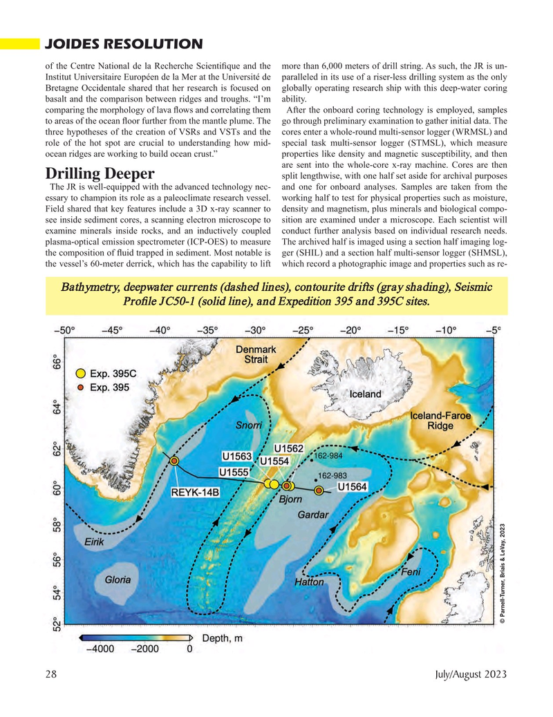
Bathymetry, deepwater currents (dashed lines), contourite drifts (gray shading), Seismic
Pro? le JC50-1 (solid line), and Expedition 395 and 395C sites.
© Parnell-Turner, Briais & LeVay, 2023 28 July/August 2023
MTR #5 (18-33).indd 28 7/21/2023 9:07:02 AM

 27
27

 29
29
