
Page 43: of Marine Technology Magazine (May 2025)
Read this page in Pdf, Flash or Html5 edition of May 2025 Marine Technology Magazine
 42
42
 44
44
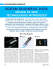
¯ Teledyne Marine ¯ Teledyne Marine ¯ Kongsberg Discovery to collect large volumes of data wireless- ibrating, highly accurate, and robust pH signed to transform how ocean data ly using AUVs and ROVs, supporting sensor from Teledyne Valeport is captured, managed and accessed. the rapidly expanding ocean economy. • Intrepid System – a GNSS/Inertial The solution enables both traditional
A dock demo hosted by Hydromea at Navigation System for unmanned sur- and uncrewed vessel operators to
OB offered attendees a ? rsthand look at face vehicles, seamlessly integrates with streamline data operations, unlock op- the capabilities of the LUMA™ FLEX- the SeaBat T20-ASV processor for pre- erational insights and improve global enabled RBRconcerto3 CTD, wirelessly cise positioning collaboration between vessels and transmitting conductivity, temperature shore-based teams.
and depth data. Teledyne Marine also announced the The bene? ts include centralized data purchase and delivery of a Gavia Au- collection and logging from all onboard
Tritonia unveiled Hydrophis, its ma- tonomous Underwater Vehicle (AUV) and remote sensors, automatic catalogu- rine data platform, at OB. Designed to one of the subsidiaries of the Sea ing and indexing to prepare data for for marine surveyors, offshore opera- Vorian group, SEA360, located in Cau- exploration and analysis, and seamless tors, and regulatory bodies, Hydrophis dan, France. The newly acquired AUV data distribution to mirrored cloud envi- changes how organizations host, visual- is equipped with technologies like the ronments or other data management sys- ize, and analyze underwater survey data EdgeTech 2205 sonar, with bathymetric tems. Visualization of data is possible by integrating advanced georeferenced and gap-? lling module, EXail PHINS with both real-time and historical data 3D photogrammetry, AI-driven analy- C3 Inertial Navigation System (INS), georeferenced in dashboards, maps, and sis, and multiple data types (such as and USBL modules. These technologies time series viewers and a high degree of side-scan sonar, orthomosaics and mul- will enable Sea360 to perform geophysi- customization available (allowing users tibeam sonar data) into one platform. cal survey missions, underwater inspec- to ? lter and tailor displays according to tions, and environmental monitoring at speci? c needs).
Teledyne Marine launched several depths of up to 1,000 meters. The Geomatics architecture is AI and new industry solutions and technologies machine learning ready, building a in Southampton this year: Kongsberg Discovery hosted product foundation for the integration of digital • Compact Navigator – the world’s demonstrations for the EM2042 Mul- twin technology and further enhancing smallest and highest performing, fully tibeam Echosounder and Seapath 385 processing capabilities. A new Analyt- integrated autonomous navigation solu- GNSS aided inertial navigation system ics product is also under development, tion is revealed at Ocean Business onboard the Fugro FTV Xplorer vessel, allowing for automated processing and • SeaBat T51-S – the enhanced SeaBat in addition to dockside demos with the in-depth data analysis.
T51 now reaches 6000m depth while Flexview multibeam sonar deployed on ensuring reliable, hands-free operation a ROV for underwater infrastructure in- GeoAcoustics Ltd debuted a new • Workhorse Proteus – an evolution spection and gas seep detection. Kongs- Side Scan Sonar range, adding to its of the original Workhorse ADCP com- berg Discovery also teamed up with Sail- hydroacoustic technology portfolio. bines ultimate ? exibility and unparal- drone to give delegates an insight into The previous GeoScan range featured leled data remote deep-water multibeam survey op- two models, both offering simultane- • BlueStreamX2 – the latest upgrade erations, with a real-time demonstration ous broadband dual frequency opera- doubles Benthos Acoustic Modems' of a Saildrone Surveyor USV ? tted with tion and advanced sonar processing (WideBand C) data rate to 4800bits EM304 MKII sensors and software. features. The GeoScan 2361 operates per second and enhances UTS topside at 300 kHz and 600 kHz to maximize systems Kongsberg Discovery also unveiled range performance, while the GeoScan • Valeport pH – an innovative self-cal- Geomatics, a new digital product de- 2491 runs at 400 kHz and 900 kHz to www.marinetechnologynews.com 43
MTR #4 (34-47).indd 43 MTR #4 (34-47).indd 43 5/27/2025 2:57:01 PM5/27/2025 2:57:01 PM