
Page 41: of Offshore Engineer Magazine (Oct/Nov 2014)
Read this page in Pdf, Flash or Html5 edition of Oct/Nov 2014 Offshore Engineer Magazine
 40
40
 42
42
is greater than the seismic resolution,
Drilling seismic data can be re? ned and better understood, especially while looking at some of the features on a seismic scale,
Seydoux says.
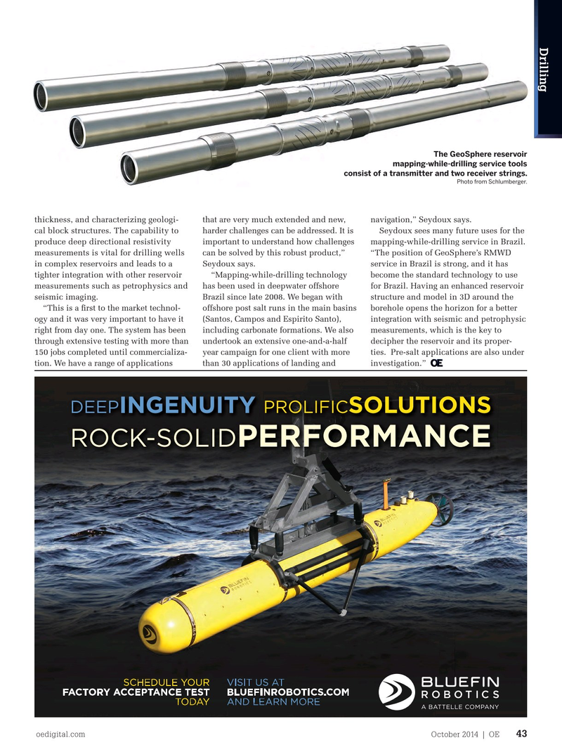
By increasing the con? dence in the knowledge of the environment drilled, the mapping while drilling helps increase rate of penetration (ROP), improve wellbore stability and hole quality, and optimize well placement. The GeoSphere reservoir mapping-while-drilling service tools
Seydoux pointed out that “the key is consist of a transmitter and two receiver strings. knowing earlier and making the right
Photo from Schlumberger.
decisions. RMWD also helps the overall drilling operation to allow for a smoother borehole. It provides better dogleg con- trol and decreases unwanted corrections thickness, and characterizing geologi- that are very much extended and new, navigation,” Seydoux says. in trajectory (going from reactive to pro- cal block structures. The capability to harder challenges can be addressed. It is Seydoux sees many future uses for the active mode). By detecting and avoiding produce deep directional resistivity important to understand how challenges mapping-while-drilling service in Brazil. potential problematic formations (shale measurements is vital for drilling wells can be solved by this robust product,” “The position of GeoSphere’s RMWD or other), it helps avoid side tracking and in complex reservoirs and leads to a Seydoux says. service in Brazil is strong, and it has offers better entry angle control. This tighter integration with other reservoir “Mapping-while-drilling technology become the standard technology to use is a reservoir mapping technology that measurements such as petrophysics and has been used in deepwater offshore for Brazil. Having an enhanced reservoir bene? ts both drillers and geologists and seismic imaging. Brazil since late 2008. We began with structure and model in 3D around the geophysicists.” “This is a ? rst to the market technol- offshore post salt runs in the main basins borehole opens the horizon for a better
There were many challenges to over- ogy and it was very important to have it (Santos, Campos and Espirito Santo), integration with seismic and petrophysic come in developing the MWD service for right from day one. The system has been including carbonate formations. We also measurements, which is the key to commercial use, as it involved proving through extensive testing with more than undertook an extensive one-and-a-half decipher the reservoir and its proper-
Deep Ingenuity - Ad 184x130_02.20.14.pdf 1 2/20/2014 9:08:11 AM the viability and ef? ciency of differ- 150 jobs completed until commercializa- year campaign for one client with more ties. Pre-salt applications are also under ent technologies. In order to attain well tion. We have a range of applications than 30 applications of landing and investigation.” placement optimization it was necessary to have a more extensive understanding of reservoir characteristics. “Four major advances make this new tool an effective technology for reser- voir imaging. First, the tool modularity enables simultaneous radial depths of investigation in excess of 30m. Second, a broad range of measurement frequencies accommodate a wide range of formation resistivity. Third, the antenna design
C offers a full directional access to the resistivity tensor acquired at each spac-
M ing and frequency. Finally, a powerful
Y real-time inversion method exploits the
CM richness of the measurements and their deep depth of investigation, providing
MY unparalleled support for the interpreta-
CY tion of complex reservoir structures,”
CMY
Seydoux says.
The individual transmitters and
K receivers provide ? exibility in the ways that the new system can be incorporated into the BHA. The multiple spacing between transmitters and receivers, along with multiple frequencies, pro- vide the best approach to address well placement in complex formations. This helps to correctly establish the location of oil water contact (OWC), while at the same time unveiling the geometry of the reservoir, including estimating reservoir oedigital.com October 2014 | OE 43 000_OE1014_D&C2_Claudio.indd 43 9/24/14 9:14 AM