Page 49: of Marine Technology Magazine (Mar/Apr 2006)
AUVs; ROVs; UUVs
Read this page in Pdf, Flash or Html5 edition of Mar/Apr 2006 Marine Technology Magazine
 48
48
 50
50
www.seadiscovery.com Marine Technology Reporter 51 proof deck unit has been updated with a higher resolution display and the ability to run MaxView or third- party acquisition and mosaicing soft- ware.
Visit www.maritimeequipment.com/mt & Click No. 7
C-Products Sells Two
Systems
C-Products Ltd. announced two C-
Boom system sales. One C-Boom sys- tem has been sold and delivered to
GEUS, the Geological Survey of
Denmark and Greenland based in
Copenhagen . This follows on from its evaluation of a system last year.
The second system along with a C-
Phone Mini Hydrophone streamer has been sold to EGS(Asia) Ltd and will join their other C-Boom sub-bot- tom profiler systems based in Asia.
The low voltage boomer technology is proving very popular with survey companies and institutes alike, with systems now owned by companies in over 10 countries worldwide
Visit www.maritimeequipment.com/mt & Click No. 8
CARIS Port
Management System
CARIS offers a full product line for port management, which includes
CARIS BEAMS for survey manage- ment and storage and for engineering functions such as bathymetric analy- sis such as vol- ume calcula- tions, surface differences and channel condition reports. CARIS PORTIS enables all the stakeholders to access information from wherever they may be on virtu- ally any PC connected to the
Internet.
Visit www.maritimeequipment.com/mt & Click No. 9
Chelsea Technologies
Chelsea Technologies Group announces a new Fast Repetition
Rate Fluorimeter for phytoplankton / algal monitoring.
The FASTtracka II combines a conven- tional chlorophyll fluorimeter with a photosynthesis-probing fluorimeter in a single package. The FASTtracka
II weighs in at 6 kg, and is about 4.5 inches in diameter and 11 inches long. The FASTtracka II is the flag- ship of a new range of instruments from Chelsea Technologies Group and incorporates as standard a large internal data store, whose entire con- tents can be downloaded within a few minutes.
Visit www.maritimeequipment.com/mt & Click No. 10
ESRI Software
ArcGIS for Ocean and Coastline
Management Geographic informa- tion system (GIS) software is used to understand and manage geographic areas such as coastal zones. ESRI's
ArcGIS software helps coastal man- agers collect, organize, and interpret vast amounts of data. In addition, 2D and 3D mapping tools of ArcGIS
Spatial Analyst and ArcGIS 3D
Products & Systems on Display at Oceanology International 2006 in London
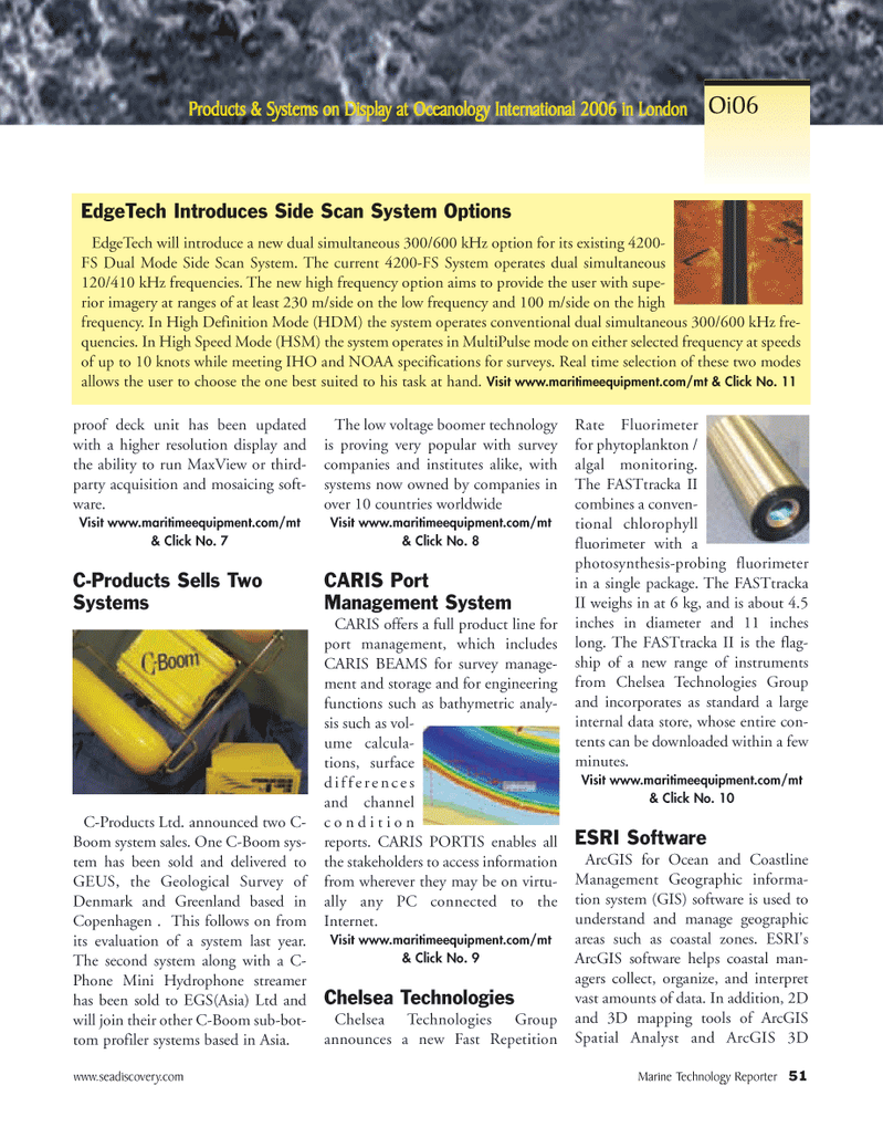
EdgeTech will introduce a new dual simultaneous 300/600 kHz option for its existing 4200-
FS Dual Mode Side Scan System. The current 4200-FS System operates dual simultaneous 120/410 kHz frequencies. The new high frequency option aims to provide the user with supe- rior imagery at ranges of at least 230 m/side on the low frequency and 100 m/side on the high frequency. In High Definition Mode (HDM) the system operates conventional dual simultaneous 300/600 kHz fre- quencies. In High Speed Mode (HSM) the system operates in MultiPulse mode on either selected frequency at speeds of up to 10 knots while meeting IHO and NOAA specifications for surveys. Real time selection of these two modes allows the user to choose the one best suited to his task at hand. Visit www.maritimeequipment.com/mt & Click No. 11
EdgeTech Introduces Side Scan System Options
Oi06
MTR#2 (49-64).qxd 2/23/2006 4:42 PM Page 51