
Teledyne Blueview Launches ProMapper Software
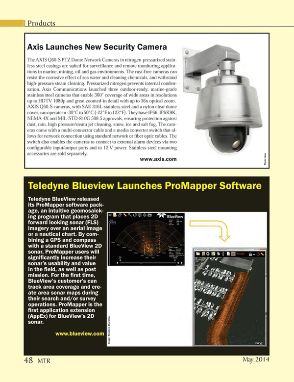
Teledyne BlueView released its ProMapper software package, an intuitive geomosaicking program that places 2D forward looking sonar (FLS) imagery over an aerial image or a nautical chart. By combining a GPS and compass with a standard BlueView 2D sonar, ProMapper users will significantly increase their sonar’s usability and value in the field, as well as post mission. For the first time, BlueView’s customer’s can track area coverage and create area sonar maps during their search and/or survey operations. ProMapper is the first application extension (AppEx) for BlueView’s 2D sonar.
www.blueview.com
(As published in the May 2014 edition of Marine Technology Reporter - http://www.marinetechnologynews.com/Magazine)
Read Teledyne Blueview Launches ProMapper Software in Pdf, Flash or Html5 edition of May 2014 Marine Technology
Other stories from May 2014 issue
Content
- Windwave Launches Damen FCS 2008 page: 13
- OSD Develops Windfarm Vessel Design Range page: 15
- Saving Coral Reefs One Shipwreck at a Time page: 16
- One Step Closer to Refloating Costa Concordia page: 17
- Bluefin Robotics on the Hunt for MH370 page: 18
- A Pivotal Year for AUVs in the Oil & Gas Sector page: 24
- Energy from the Ocean page: 28
- MHI, Vestas Wind Joint Venture Underway page: 34
- Fisheries Technology for Resource Management page: 36
- AGOR 27 Comes to Life as the R/V Neil Armstrong page: 40
- Product Spotlight Remote Control Boats page: 46
- WFS seatooth S100 page: 47
- Modem Field Evaluation Program page: 47
- Axis Launches New Security Camera page: 48
- Teledyne Blueview Launches ProMapper Software page: 48
- MSI Delivering SAS Components for Raytheon’s Surveyor Solutions page: 49
- Bowtech: New Tooling Camera Range page: 49
- iXBlue: New GAPS USBL page: 49
- Ifremer Receives Scientific Multibeam page: 50
- MacArtney Ice Core Drilling Winch for BAS page: 51
- EIVA Opens New Webshop page: 51
- UDT 2014 Set for Liverpool, June 10-12 page: 58