
Page 19: of Marine Technology Magazine (Nov/Dec 2021)
Ocean Observation: Gliders, Buoys & Sub-Surface Networks
Read this page in Pdf, Flash or Html5 edition of Nov/Dec 2021 Marine Technology Magazine
 18
18
 20
20
liaq since 2013, when the ship was built.
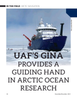
The Sikuliaq, a 261-ft. ice-capable
Steve Roberts, the Sikuliaq’s science systems engineer, got research vessel operated by UAF, the idea for the map server while working aboard the USCGC
Healy, the Coast Guard’s icebreaker, and has re? ned his sys- pauses in the Arctic Ocean in June tem over the years.
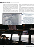
2021 during its ? fth year of operation. “I remember every day scientists on the Healy continually saying, “Where are we?’,” he said from aboard the Sikuliaq as he research vessel Sikuliaq navigated among and it sailed in ice-strewn waters about 350 miles north of Alas- around the chunks and slabs of Arctic sea ice above ka. Ice occasionally banged the hull as he spoke. “There was
Alaska for several weeks on two voyages this fall, nothing on the ship that provided information relative to the
T breaking through frozen slabs when it had to, just as science missions. We need to know where we are relative to science stations and moorings. its sturdy hull is designed to do. It’s now on a third trip.
“When you are working in ice, the ice controls where you
The Sikuliaq, a 261-ft. ice-capable research vessel operated by
UAF, pauses in the Arctic Ocean in June 2021 during its ? fth are,” he said. “Knowing where sea ice is at all times is critical.” year of operation. A few months later, it traveled farther north
Eyes in the Sky than ever before — almost 500 miles beyond Point Barrow.
Satellite imagery produced at the Geographic Information Navigating sea ice is a burgeoning ? eld of interest as ship-
Network of Alaska, or GINA, at the University of Alaska Fair- ping increases in the Arctic, which is becoming increasingly banks Geophysical Institute helps the Sikuliaq weave its way open though not entirely ice-free. Icebergs from coastal sourc- through the ice. es still bob along, and thick slabs of sea ice still drift.
The satellite images, along with satellite data from other The National Snow and Ice Data Center notes that satellites sources, show up on the Sikuliaq’s bridge in an easy-to-use have only been continuously monitoring sea ice since 1979. web-based map server. The map server has been on the Siku- Prior to that, captains had to rely on their crews’ ? rsthand ob-
Making Hydrographers’ Tasks Easier
Courtesy of Cadden
Navsight Marine Solution Qinertia
The Next Generation INS/GNSS
State-of-the-art Motion
Post-processing Software & Navigation Solution www.sbg-systems.com www.marinetechnologynews.com 19
MTR #8 (18-33).indd 19 11/22/2021 11:51:03 AM