Page 20: of Marine Technology Magazine (November 2021)
Ocean Observation: Gliders, Buoys & Sub-Surface Networks
Read this page in Pdf, Flash or Html5 edition of November 2021 Marine Technology Magazine
In the FIeld ARCTIC NAVIGATION servations and on weekly ice charts based on airborne observa- Sikuliaq’s voyages. The National Science Foundation owns tions and reports from observers on the coasts and other ships. the Sikuliaq, a part of the U.S. academic research feet, and
Avoiding the ice is often best for the scientists, who usually the UAF College of Fisheries and Ocean Sciences operates have a limited amount of time to get what they need from the the ship.
open water. That was the situation on a seven-week research “There’s tight interaction between the navigator and the sci- voyage UAF geophysics professor Bernard Coakley took into entists,” Roberts said. “Scientists can determine where the the Chukchi and Beaufort Seas and with a Navy-funded voy- ship goes, but a lot of times it’s the ice that decides.” age in some of the same waters. “Scientists need to maintain situational awareness of the
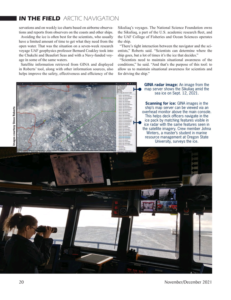
Satellite information retrieved from GINA and displayed conditions,” he said. “And that’s the purpose of this tool: to in Roberts’ tool, along with other information sources, also allow us to maintain situational awareness for scientists and helps improve the safety, effectiveness and effciency of the for driving the ship.”
GINA radar image: An image from the map server shows the Sikuliaq amid the sea ice on Sept. 12, 2021.
Scanning for ice: GINA images in the ship’s map server can be viewed via an overhead monitor above the main console.
This helps deck offcers navigate in the ice pack by matching features visible in ice radar with the same features seen in the satellite imagery. Crew member Johna
Winters, a master’s student in marine resource management at Oregon State
University, surveys the ice.
Images courtesy Steve Roberts 20 November/December 2021

 19
19

 21
21
