
Floating LiDAR System
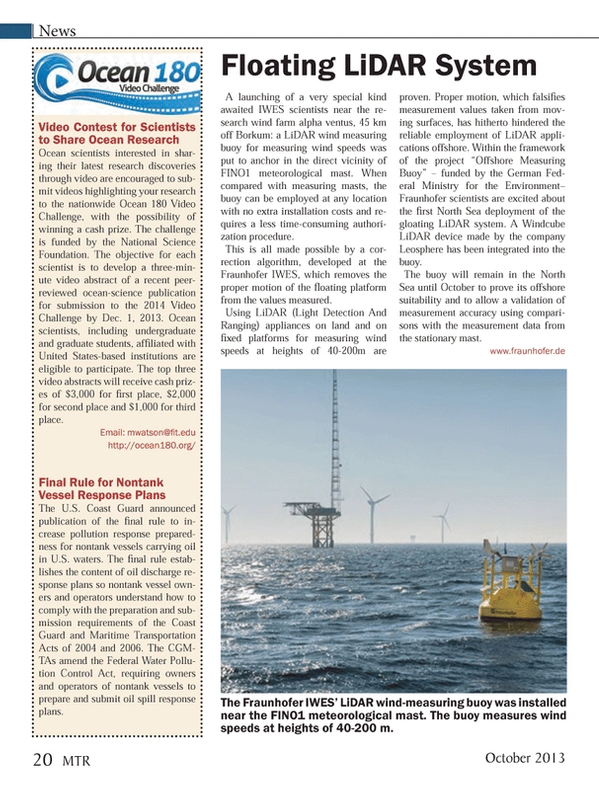
A launching of a very special kind awaited IWES scientists near the research wind farm alpha ventus, 45 km off Borkum: a LiDAR wind measuring buoy for measuring wind speeds was put to anchor in the direct vicinity of FINO1 meteorological mast. When compared with measuring masts, the buoy can be employed at any location with no extra installation costs and requires a less time-consuming authorization procedure.
This is all made possible by a correction algorithm, developed at the Fraunhofer IWES, which removes the proper motion of the floating platform from the values measured.
Using LiDAR (Light Detection And Ranging) appliances on land and on fixed platforms for measuring wind speeds at heights of 40-200m are proven. Proper motion, which falsifies measurement values taken from moving surfaces, has hitherto hindered the reliable employment of LiDAR applications offshore. Within the framework of the project “Offshore Measuring Buoy” – funded by the German Federal Ministry for the Environment– Fraunhofer scientists are excited about the first North Sea deployment of the gloating LiDAR system. A Windcube LiDAR device made by the company Leosphere has been integrated into the buoy.
The buoy will remain in the North Sea until October to prove its offshore suitability and to allow a validation of measurement accuracy using comparisons with the measurement data from the stationary mast.
fraunhofer.de
(As published in the October 2013 edition of Marine Technology Reporter - www.seadiscovery.com)
Read Floating LiDAR System in Pdf, Flash or Html5 edition of Oct/Nov 2013 Marine Technology
Other stories from Oct/Nov 2013 issue
Content
- Increase in Demand for the Hot Subsea Vessel Market page: 8
- Oceaneering Taps BAE Systems to Build New Subsea Support Vessel page: 12
- Van Oord Contracts Damen for DP2 Cable Laying Vessel page: 14
- MHI to Build RV for JAMSTEC page: 14
- OSD-IMT Wins Contracts for COSL page: 16
- IHC Merwede Launches Pipelaying Vessel page: 17
- Cyclops: A Revolutionary Hull Design page: 18
- Floating LiDAR System page: 20
- Satellite Images Capture Tanker Pollution page: 21
- Baltic Wind Success Paves Way for Ecosse page: 23
- National Ocean Policy, Coastal & Marine Spatial Planning Raising Red Flags page: 24
- One-on-One with SMAST’s Steven E. Lohrenz page: 26
- From Learning to Earning page: 30
- AUV Deployment by the U.S. Navy 5th Fleet page: 36
- ICTINEU 3 Development of a Research Submersible page: 38
- ARGUS Enviable Technology, Unlimited Potential page: 42
- Improved eBird page: 52
- New Additions to Imagenex Line page: 52
- AMEC Buys AXYS Sensor page: 52
- The Cavidome page: 52
- GE Dynamic Positioning page: 53
- Seatronics, CodaOctopus Agree page: 54
- Shark Eye page: 54
- CTI SonarWiz Update page: 54
- Compact Survey AUV page: 55
- New NEXUS HD Multiplexer from MacArtney page: 56
- Tritech’s RAMS Integrity Monitoring Technology page: 56
- Mustang Launches Ocean Commander Immersion Suit page: 56
- Reservoir Modeling Platform page: 56
- MacArtney Inline Termination for Andritz Hydro Hammerfest page: 57
- EIVA: New Winch Range page: 58
- MetOcean Snow Beacon page: 58
- Free Web-Embeddable Map Widgets page: 58