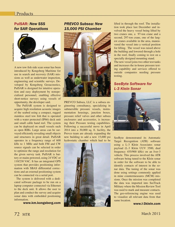
PulSAR: New SSS for SAR Operations
A new tow fish side scan sonar has been introduced by Kongsberg Maritime for use in search and recovery (SAR) missions as well as underwater inspection, engineering and scientific surveys. Developed by Kongsberg Geoacoustics, PulSAR is designed for intuitive operation and easy deployment by nonspecialized personnel, enabling effective short-notice surveys using vessels of opportunity, the developer said.
The PulSAR system is designed to acquire high resolution acoustic images of the seabed using a compact, rugged stainless steel tow fish that is operated with a water protected (IP66) deck unit and small cable hand reel. The system can be deployed on small vessels such as open RIBs. Large areas can be surveyed efficiently revealing small objects and structures in great detail. PulSAR operates in a frequency range of 600 kHz to 1 MHz and both FM and CW source signals can be selected in order to optimize the range and resolution for the given survey task. PulSAR is battery or mains powered, using 24 VDC or 110/230 VAC. It has an integrated GPS system that provides positioning information with SBAS differential corrections and an external positioning system can be connected via a serial port.
The system is delivered with a dedicated software package to be run on a laptop computer connected via Ethernet to the deck unit. It allows the user to plan and conduct the survey and acquire sonar data with embedded positioning information.
www.km.kongsberg.com
(As published in the March 2015 edition of Marine Technology Reporter - http://www.marinetechnologynews.com/Magazine)
Read PulSAR: New SSS for SAR Operations in Pdf, Flash or Html5 edition of March 2015 Marine Technology
Other stories from March 2015 issue
Content
- MTR March Editorial page: 6
- Virtual Aids to Navigation Mark Research Equipment page: 14
- New Research Vessel for Greenland page: 16
- New Dive Support Vessel for N-sea page: 18
- New Survey Vessel for Port of London page: 20
- Construction Vessel Delivered to Eidesvik page: 20
- Wind Farm Vessel Named page: 20
- Gliders (Silently) Making O&G Ops Cheaper, More Efficient page: 22
- Seafloor Mapping Aids Safety & Efficiency page: 26
- Mapping the Abyss with AUV Photography page: 32
- Insights: NOAA's Dr. Holly A. Bamford page: 40
- Adventure Under Ice page: 50
- The World’s Cold Ocean Lab page: 58
- Newfoundland and Labrador: Sensing Success page: 63
- Virtual Worlds: Newfoundland and Labrador's Simulator Tech page: 66
- PulSAR: New SSS for SAR Operations page: 72
- PREVCO Subsea: New 15,000 PSI Chamber page: 72
- SeeByte Software for L-3 Klein Sonar page: 72
- SeaBotix LBV Performs for Lake Erie Diving page: 73
- WiFi & GPS to X-Series Profilers page: 73
- STR SeaSpyder Systems for AIFCA page: 73
- Software Aids Subsea Power Cable Installation page: 74
- Sonardyne Ranger 2 for Pioneering Spirit page: 74
- OSIL & ASV: Mooring-free Buoy Launched page: 74
- SWE’s New Portable Power System page: 74
- Waveblade Tested at The Underwater Center page: 74
- Sonar Makers Partner for Seagrass Surveys page: 75
- Kongsberg Connects Seismic Vessels page: 75
- TE Connectivity INSTALITE Boots page: 76
- Outland Technology LED Laser Light page: 76
- Tritech Sonars for Swedish Navy ROVs page: 76
- New Subsea Modular Spreader Beams page: 76
- Teledyne TSS’s Saturn AHRS and INS page: 76
- ValeportDebuts New Datalog Software page: 76
- Nav Charts App Launched page: 76
- New Tool Recovers Oil from Sunken Wrecks page: 77


