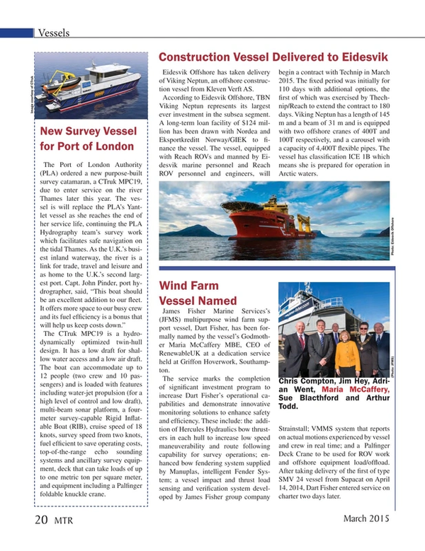
New Survey Vessel for Port of London
The Port of London Authority (PLA) ordered a new purpose-built survey catamaran, a CTruk MPC19, due to enter service on the river Thames later this year. The vessel is will replace the PLA’s Yantlet vessel as she reaches the end of her service life, continuing the PLA Hydrography team’s survey work which facilitates safe navigation on the tidal Thames. As the U.K.’s busiest inland waterway, the river is a link for trade, travel and leisure and as home to the U.K.’s second largest port. Capt. John Pinder, port hydrographer, said, “This boat should be an excellent addition to our fleet. It offers more space to our busy crew and its fuel efficiency is a bonus that will help us keep costs down.”
The CTruk MPC19 is a hydro-dynamically optimized twin-hull design. It has a low draft for shallow water access and a low air draft. The boat can accommodate up to 12 people (two crew and 10 passengers) and is loaded with features including water-jet propulsion (for a high level of control and low draft), multi-beam sonar platform, a four-meter survey-capable Rigid Inflatable Boat (RIB), cruise speed of 18 knots, survey speed from two knots, fuel efficient to save operating costs, top-of-the-range echo sounding systems and ancillary survey equipment, deck that can take loads of up to one metric ton per square meter, and equipment including a Palfinger foldable knuckle crane.
(As published in the March 2015 edition of Marine Technology Reporter - http://www.marinetechnologynews.com/Magazine)
Read New Survey Vessel for Port of London in Pdf, Flash or Html5 edition of March 2015 Marine Technology
Other stories from March 2015 issue
Content
- MTR March Editorial page: 6
- Virtual Aids to Navigation Mark Research Equipment page: 14
- New Research Vessel for Greenland page: 16
- New Dive Support Vessel for N-sea page: 18
- New Survey Vessel for Port of London page: 20
- Construction Vessel Delivered to Eidesvik page: 20
- Wind Farm Vessel Named page: 20
- Gliders (Silently) Making O&G Ops Cheaper, More Efficient page: 22
- Seafloor Mapping Aids Safety & Efficiency page: 26
- Mapping the Abyss with AUV Photography page: 32
- Insights: NOAA's Dr. Holly A. Bamford page: 40
- Adventure Under Ice page: 50
- The World’s Cold Ocean Lab page: 58
- Newfoundland and Labrador: Sensing Success page: 63
- Virtual Worlds: Newfoundland and Labrador's Simulator Tech page: 66
- PulSAR: New SSS for SAR Operations page: 72
- PREVCO Subsea: New 15,000 PSI Chamber page: 72
- SeeByte Software for L-3 Klein Sonar page: 72
- SeaBotix LBV Performs for Lake Erie Diving page: 73
- WiFi & GPS to X-Series Profilers page: 73
- STR SeaSpyder Systems for AIFCA page: 73
- Software Aids Subsea Power Cable Installation page: 74
- Sonardyne Ranger 2 for Pioneering Spirit page: 74
- OSIL & ASV: Mooring-free Buoy Launched page: 74
- SWE’s New Portable Power System page: 74
- Waveblade Tested at The Underwater Center page: 74
- Sonar Makers Partner for Seagrass Surveys page: 75
- Kongsberg Connects Seismic Vessels page: 75
- TE Connectivity INSTALITE Boots page: 76
- Outland Technology LED Laser Light page: 76
- Tritech Sonars for Swedish Navy ROVs page: 76
- New Subsea Modular Spreader Beams page: 76
- Teledyne TSS’s Saturn AHRS and INS page: 76
- ValeportDebuts New Datalog Software page: 76
- Nav Charts App Launched page: 76
- New Tool Recovers Oil from Sunken Wrecks page: 77


