
Page 27: of Marine Technology Magazine (June 2016)
Hydrographic Survey
Read this page in Pdf, Flash or Html5 edition of June 2016 Marine Technology Magazine
 26
26
 28
28
data quickly and then turn that data into usable models. GNSS modular receivers now have the capability of monitoring tidal and other water level changes in real-time, providing a more precise and cost-effective solution than conventional methods, meaning, tide gauges and as- sociated radio links are no longer essen- tial. Additionally, GNSS receivers with more rugged designs have made them well suited for temporary and permanent installations in extreme environments.
Improvements in marine GNSS hard- ware have also dovetailed with stronger, more ef? cient software that can be inte- grated across multiple platforms, allow- ing project crews to share data and create the necessary models based on the data collected. By connecting this software to receivers and other sources of sensor data (like an echosounder, for instance), project engineers can determine real- time position, heading and the precise elevation of the target surface.
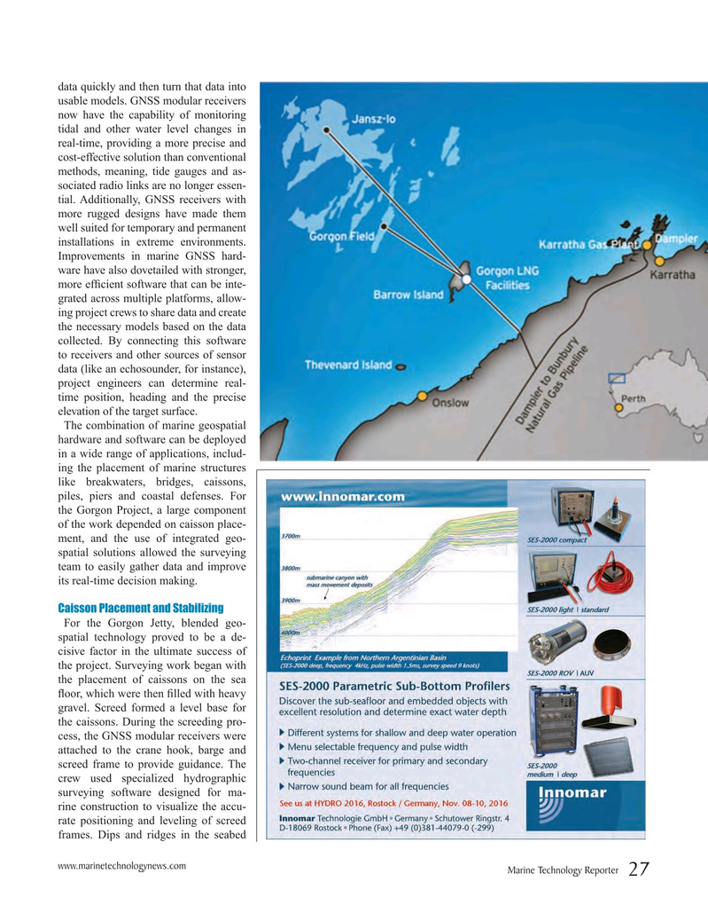
The combination of marine geospatial hardware and software can be deployed in a wide range of applications, includ- ing the placement of marine structures like breakwaters, bridges, caissons, piles, piers and coastal defenses. For the Gorgon Project, a large component of the work depended on caisson place- ment, and the use of integrated geo- spatial solutions allowed the surveying team to easily gather data and improve its real-time decision making.
Caisson Placement and Stabilizing
For the Gorgon Jetty, blended geo- spatial technology proved to be a de- cisive factor in the ultimate success of the project. Surveying work began with the placement of caissons on the sea ? oor, which were then ? lled with heavy gravel. Screed formed a level base for the caissons. During the screeding pro- cess, the GNSS modular receivers were attached to the crane hook, barge and screed frame to provide guidance. The crew used specialized hydrographic surveying software designed for ma- rine construction to visualize the accu- rate positioning and leveling of screed frames. Dips and ridges in the seabed www.marinetechnologynews.com
Marine Technology Reporter 27
MTR #5 (18-33).indd 27 6/1/2016 5:21:06 PM