While substantial amounts of petroleum reserves exist in the Arctic—30% of the undiscovered gas and 13% of the undiscovered oil, according to the U.S. Geological Survey’s 2009 estimates — there are hurdles that need to be cleared before oil and gas companies can efficiently operate there. A high priority is to be able to accurately predict the forces that nearby ice floes would exert on a vessel’s hull upon impact, and have the ability to react to this information in a timely manner (see sidebar, page 48). A Dynamic Positioning (DP) system outfitted to operate in managed ice (following icebreaking) would satisfy this requirement. It needs to (1) be equipped with predictive capability, (2) be able to determine the counterforce that will be required to offset the force of ice collision, (3) “know” the limitations of the vessel’s engine power and propulsion system, (4) recognize when ice loads will exceed these limits and provide a signal to the DP Operator, and (5) when the force of impact of ice loads is within the vessel’s limits, automate the response from the thrusters and propulsion system required to maintain station. Such a DP system would be particularly valuable for a drillship when carrying out operations. When the system notifies the DP Operator that the vessel will be unable to maintain its position due to the magnitude of the ice loads, the operator would then ensure that the drill string and risers are pulled, there would be a controlled, safe disconnect from the seafloor, and the vessel would be moved. Since DP systems were designed to operate in open water, significant technology developments and modifications are required to enable operations in ice environments. Model testing and simulation—both in the development of an ice model and the visualization of mathematically based scenarios—are playing key roles in an applied research project underway in St. John’s, Newfoundland and Labrador.
The Center for Marine Simulation (CMS) at the Fisheries and Marine Institute of Memorial University in St. John’s, in partnership with the Government of Canada’s National Research Council Ocean, Coastal and River Engineering (NRC OCRE) also in St. John’s and Kongsberg Maritime Simulation Ltd., are conducting a five-year research project to address these issues. The funding totals $8.6 million ($C), including $1.8 million in in-kind contributions. The funders include Petroleum Research Newfoundland & Labrador, the Government of Canada through the Atlantic Canada Opportunities Agency, Research & Development Corporation of Newfoundland and Labrador and Kongsberg Maritime.
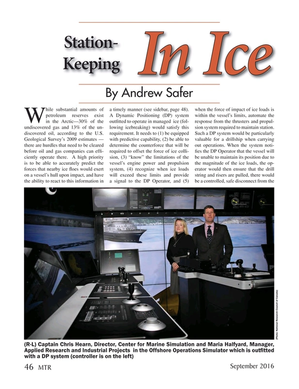
“If you can extend the weather window in the Arctic by one month, that would be huge,” says Maria Halfyard, CMS’ Manager of Applied Research and Industrial Projects, and Project Manager. “They’re spending millions of dollars a day in time up there.” Referring to recent restrictions on drilling in the Canadian Arctic post-Macondo, she adds that oil companies don’t have enough time to drill two wells in one season. “If our technology allows them to do this, that would be significant for them.” Since the kick start of this project in May 2014, Halfyard has spoken to half a dozen oil companies, all of whom have confirmed the high priority of developing DP capability in ice-infested waters.
One of the major challenges on the CMS side of the project is addressing the complexity of simulating ice. “Ice simulation is still in its infancy,” says Halfyard. “Our aim is to develop the best ice simulation out there. We want it to look as realistic as possible, including fracture, color, and floes responding to and bouncing off each other, and breaking.”
The approach of the CMS project includes testing a fully instrumented model drillship in an ice tank at NRC OCRE, and sending the ice-ice and ice-ship interaction data to the numerical researchers and software engineers who are building an ice model, who then send scenarios to CMS where visualizations are created and simulations are run onscreen. Kongsberg Maritime will then assess the fidelity of the ice model and DP response and determine what modifications their DP system requires for integration.
At NRC OCRE, which boasts one of the world’s longest ice tanks (90 x 12 m), a team of ice and software engineers are working on model testing and building a numerical ice model. Ice engineers have conducted tests with a DP-equipped model drill ship (1:40 scale) in the ice tank, which holds 76m of ice. Managed first-year ice up to two meters in thickness was specified. The testing began with the ice field designer coding each piece of ice to represent its geometry, toughness, type and thickness. The tests provided ice-ice and ice-ship interaction data, collected as the drillship proceeded across the tank. This information was passed to the ice modelers / software engineers who are analyzing the data and developing formulas (algorithms) to represent the measured forces. Based on this data, they are currently building the numerical ice model.
The physical model used for testing is self-contained, providing its own power to the thruster and data acquisition systems onboard. An optical six-degree-of-freedom system is used to track the position and orientation of the model. NRC OCRE’s in-house DP system is used to maintain station and record forces and moments. A camera is mounted over the bow with the purpose of observing ice-ice and ice-hull interaction. There are three azimuthing podded propellers fore, and three aft. Since a wireless network is connected to the model, there is no need for a tether.
The ice produced in the tank—equivalent to first-year ice—was cut from a sheet into ¼-metre floes. Over the ensuing days, as a result of the impacts, variations in size and thickness developed, reports David Millan, OCRE System Engineer and NRC Project Manager, at which point the tank more closely resembled a real-world managed ice field. The ice thickness ranged from 15 millimetres to 32 millimetres to 50 millimetres. Millan’s team conducted almost 40 days of testing, finishing up in March 2015. They used 17 full-tank ice sheets, and made 372 model test runs (three runs per length of the tank), which yielded terabytes of data.
Software engineers reformat the data to provide ice type and ice field characteristics, which is then fed into one of three algorithms that focus on collisions, loading and the motion of the ice. “The boat is moving through the ice,” explains Millan. “According to how it’s pressured by the ice, there’s a response—a pushing back by the thrusters.” Successive calculations produce realistic ice-loading information, based on data collected from the real-world tests.
The plan is for the OCRE team to send this data to the CMS team, who will represent the scientific information visually. Each piece of ice is specified according to type, shape (number of vertices), thickness and location. The information transferred to CMS will include ice field, ship, wave and wind scenarios, and force interaction components. The embedded complexity of shapes and sophisticated rendering methods used by CMS will result in a very high fidelity look and feel to the simulation.
To create the visualization, the appropriate visual representation will be wrapped around the ice geometry. The CMS team will then display the 3D scientifically-based real-time visualizations on three 55-inch screens, arranged side-by-side with an angle between them representing a 150-degree horizontal view. A fourth screen will enable walking around different areas of the vessel and changing one’s point of view (this is the screen set-up that CMS instructors currently use for DP training). The numerical ice model will then be tested on NRC OCRE’s DP system. Once positive results are obtained regarding how the vessel responds in an ice field, that will validate that the integration of the numerical ice model and DP system is working well. The next step will then be to integrate this into a commercial DP Control System, which is where Kongsberg Maritime comes in.
By the end of the project, “we hope to have a prototype,” says Halfyard. “There are people who are skeptical because ice is so unpredictable. They’re saying, ‘Can you really build a numerical ice model that is realistic for the type of ice conditions that we get? I keep telling them, ‘Just think outside the box.’ Let’s push past what we know, and create something innovative. We can be the group that develops this new technology.”
Evolving the prototype into a commercially available product will extend well beyond the life of the project, says Halfyard. The objective of this project is to develop a proof of concept that can be commercialized by a DP manufacturer. “It will likely take years to bring to market, as significant full-scale testing would need to occur,” Halfyard observes. “But then again, innovation takes time and patience.”
Station-Keeping in Ice: A Priority
After consulting with subject matter experts from oil and gas companies and other organizations / institutions with Arctic expertise, the Centre for Arctic Resource Development (CARD) in St. John’s completed its Arctic Development Roadmap in 2012. The purpose of the Roadmap was “to identify, organize and prioritize key research and development issues that need to be addressed to fill gaps in the knowledge, technology, methodology and training associated with offshore Arctic oil and gas development.”
The oil and gas companies that were consulted for the CARD Roadmap included Exxon Mobil, Suncor, Husky Energy, Statoil, Chevron, Imperial Oil, Shell and Conoco Phillips. Among the needs that were identified as high priority was station-keeping in ice using either mooring or dynamic positioning. The limiting case used for design was station-keeping during emergency response, which pointed to the need for “improved ice load models (and full-scale data) for floating platforms to guide the design of station-keeping systems.”
A Rude Awakening
“When I first went to the Arctic in the early ‘90s, the statistics said there was a very small chance that there would be a vast ice floe,” recalls David Millan, who was working for NORDCO of St. John’s as the Engineering Project Lead. His mission was to collect and analyze data on a brand new digital radar system on board a 1,000-foot long icebreaking cargo ship (now MV Arctic). He climbed aboard in Antwerp and was heading for Nanisivik on Baffin Island. While travelling at 6 knots, the ship came to an abrupt halt. It had hit a massive ice floe. “It practically threw people off their feet,” Millan recalls. “We waited three days for the Canadian Coast Guard’s Sir John A. MacDonald to break us free. On the same trip heading south to North Sydney, the Arctic encountered 17-m seas close to the ice edge.” One of the hulls cracked on the next voyage, which Millan figures was probably due to the impact and massive seas. Ever since, Millan has been aware of the need for superior ice detection capability and technology solutions that can make Arctic voyages safer.