
Page 26: of Marine Technology Magazine (September 2016)
Ocean Observation: Gliders, Buoys & Sub-Surface Networks
Read this page in Pdf, Flash or Html5 edition of September 2016 Marine Technology Magazine
 25
25
 27
27
ydrographic charting is becoming more important metric readings taken from the surface and the complex step outside the world of shipboard navigation as both of gathering a shoreline compilation coordinated with the tide. industry and conservation have gone offshore to Almost all surveys near coastal regions have typically been
Hmeet the increasing demands of a growing global preceded by a coastal mapping effort. population. By 2020, the subsea sector of oil exploration and The purpose of this was to provide a frame of reference for extraction is expected to account for 20% of total crude oil the ocean data the hydrographer gathered at sea and also to es- production. In addition, global marine ? sheries, which pro- tablish and identify objects in the nearshore region that might vide 15% of all animal protein consumed by humans, have be dangerous. However, up to now, there have only been two been steadily collapsing for the last half century. As the needs ways to obtain this crucial step in the creation of a topobathy- of developed economies grow, so too must the tools to un- metric dataset. A hydrographer might physically observe derstand the new marine environments from which humanity critical shoreline points with the aid of ellipsoidal-referenced seeks to satisfy those needs. Hydrographic surveys will be- bathymetry at high water or use an airplane with lidar to ? y come more valuable information resources as the survival of over the shore and take readings—called point-clouds—in the planet and global prosperity become increasingly tied to clear waters or at low tide where possible. The ? rst approach the geography and ecosystem of the sea. is slow and riddled with the potential for unsafe operations due to human error, and the second can be prohibitively ex-
A Flawed Work? ow pensive. Airplanes are also limited by where they can take off,
While the demand for hydrographic resources to assist airspace regulations and maneuverability. Shoreline areas that emerging enterprises has increased dramatically over the last are remote, not easily accessible and which have rough terrain 30 years, the rate at which this data becomes available to key present obstacles for both ground-based and airborne shore stakeholders has remained rooted in an outdated work? ow mapping efforts. Additionally, if there is a change in the fore- that creates inef? ciencies and delays. The construction of a shore, such as manmade infrastructure, it can take months to hydrographic chart is a twofold process consisting of bathy- observe again and correct inaccurate products.
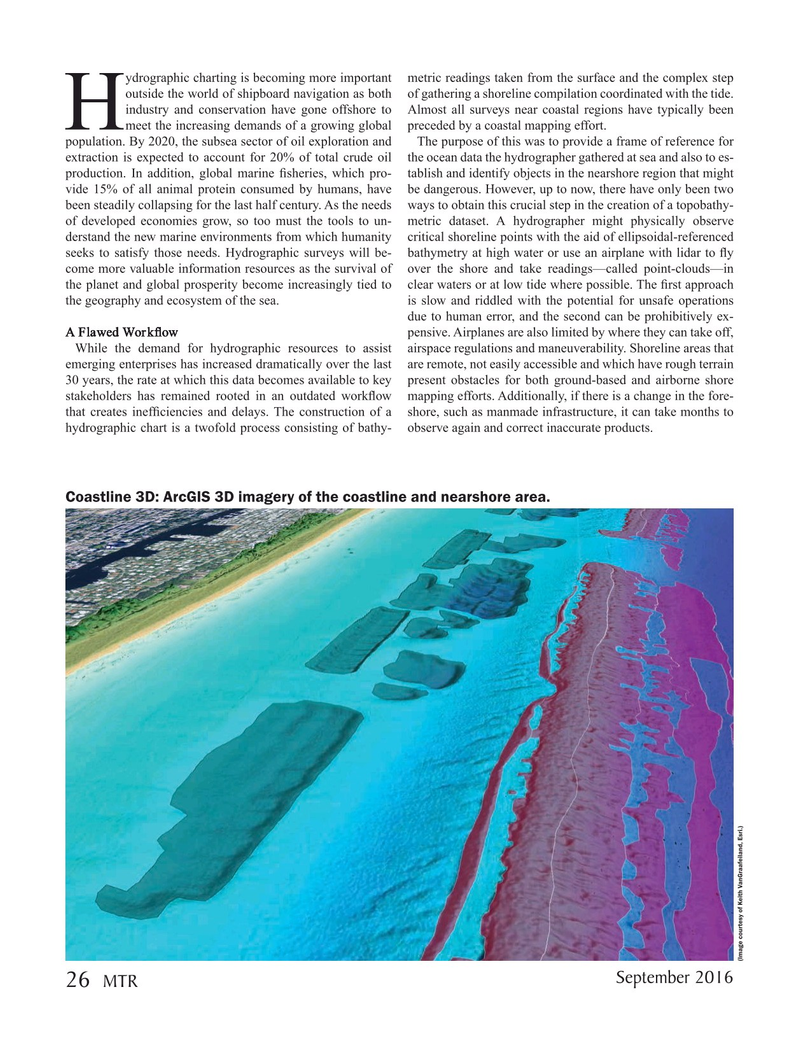
Coastline 3D: ArcGIS 3D imagery of the coastline and nearshore area. (Image courtesy of Keith VanGraafeiland, Esri.)
September 2016 26 MTR
MTR #7 (18-33).indd 26 8/24/2016 12:24:01 PM