The study of extreme wave events in the ocean has become a popular area of research in recent years. Aside from seafarers, extreme waves impact coastal communities and are of great interest to marine renewable energy companies. This is particularly prevalent in the face of coastal erosion, rising sea levels and uncertainty in how the wave climate will change in a warming world. However, much of the current research is based on modeling and experiments. Extreme wave events – including storm waves, rogue waves, storm surges and tsunamis – are rare, and as such are difficult to observe and measure. Usually the wave categories are divided into two streams: long waves and short waves. Generally, the ratio of depth to wavelength is used as a parameter to differentiate between long and short waves. Tsunamis and storm surges are typically very long waves, so they are considered shallow water waves. Storm waves and rogue waves are much shorter in wavelength relative to ocean depth.
The west coast of Ireland is a perfect location to observe extreme waves, especially when it comes to storm waves and rogue waves. Indeed, Atlantic swells propagate eastward toward the coastline of Ireland. Depressions from the Atlantic regularly bring very unsettled weather across Ireland. A few weeks ago, post-tropical cyclone Ophelia towered waves to the coast of Ireland, with a number of record breaking wave heights.
Definition of rogue waves: Oceanographers describe the sea state with a statistical measure called the significant wave height. This is the average height of the one-third highest waves. A rogue wave is one that is more than double the significant wave height. Rogue waves are sometimes called freak waves, but this is misleading: although they are rare and extreme, rogue waves are part of the normal behavior of the oceans.
Ocean wave measurement usually uses spectral approaches developed in the 1950s. Surface waves are recorded with a fixed length time series (usually 20 minutes) from which are derived nominal wave spectra. Hardware is based on wave staffs, wire gauges, buoys or underwater acoustic sensors, but device cost means that measurements are made at a single point. These existing techniques have deficiencies: (i) many of the most dangerous wave classes on the ocean either cannot be measured at all or are inaccurately recorded because of sampling deficiencies; (ii) existing wave buoys cannot reliably measure processes such as wave breaking or rogue waves which are all better characterized as instantaneous phenomena and which do not appear in average wave spectra; (iii) sensor cost precludes wide area deployment and inhibits measurement of full spatio-temporal wave evolution dynamics. Buoys only measure accelerations, and a double integration provides displacement. Also, the buoy sensor in the case of a usual Datawell is gimballed in the buoy and can produce spurious large values if the buoy is rotated. Satellite measurements (altimetry) only provide significant wave heights.
The Irish winter of 2013-2014 was severely affected by many storms due to the atmospheric jet stream extending right over Ireland carrying successive storms. This exceptional weather combined with high tides resulted in serious coastal damage and widespread flooding. An altimeter pass in the Eastern Atlantic detected phenomenal significant wave heights near 19m just west of Ireland.
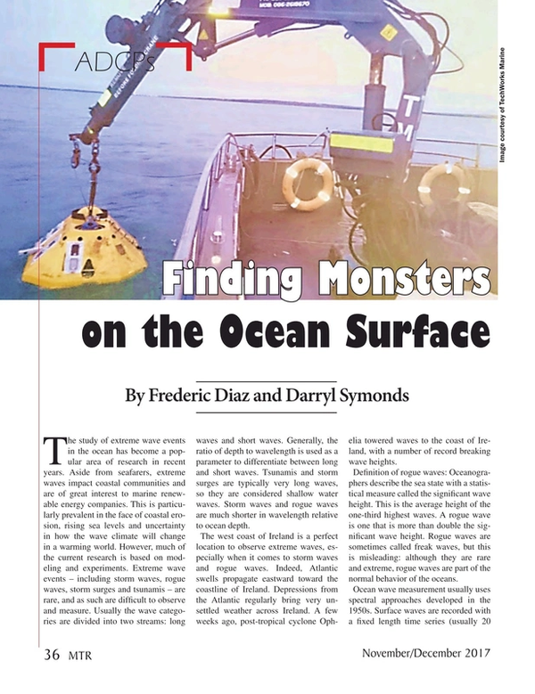
Prof. Frederic Dias from University College Dublin then decided to organize a measuring campaign for the following winter (2014-2015). He concluded that the best instrument to capture extreme wave events off the west coast of Ireland was an Acoustic Doppler Current Profiler (ADCP). In collaboration with Teledyne RD Instruments (TRDI), a Sentinel V ADCP was deployed in 36m of water at a site off the west coast of Ireland during the winter of 2015 (the experiment was repeated during the winters of 2016 and 2017), with the aim of gathering accurate wave measurements in extreme conditions.
The Sentinel V was gimbal-mounted and housed within a trawler-resistant frame and secured to the seabed in an upward-looking configuration. The Sentinel V is one of the latest in a line of ADCP developed by TRDI. It utilizes sonar pulses along five beams to gather measurements of both orbital velocity and echo intensity at predetermined distances (bins) along each beam. The five beams are arranged in the so-called Janus configuration, with beam five in the vertical and beams one-four offset at some predefined angle from the vertical. For this deployment, the Janus angle was 25 (degrees) and 34 bins, each separated by 1.2 m from center to center, were selected along each beam.
The nominal vertical distances from the ADCP transducer head to the centers of the first and last bin were approximately 26m and 66m, respectively, giving an effective range of measurement from about 10m below to 30m above the Mean Water Level (MWL). In addition to Doppler readings, pressure was recorded by the Sentinel Vs onboard sensor. The Sentinel V had on board a 16GB memory card. Pitch and Roll readings were recorded by the ADCP’s onboard micro electromechanical systems (MEMS) accelerometers.
Velocities and backscatter intensity were recorded along the five beams continuously at 2 Hz for three months. Continuous sampling enabled the capture of details of several giant events with crest-to-trough heights more than 22m. Several theoretical explanations have been proposed for such extreme waves, in particular modulational instability and directional focusing. Typical oceanic wind seas are short-crested, or multidirectional, wave fields and their dynamics is more ‘free’ than the 1D ‘long-wave-guide’ counterpart. Indeed, energy can spread directionally and as a result nonlinear focusing due to modulational instability is diminished. The recorded extreme wave is 22m peak to trough, but does not show any characteristic nonlinear features such as depleted adjacent waves or unusual steepness. Instead it appears more like a standard wave group produced by superposition. What we saw during this extreme event is a group of waves that is moving and grows in amplitude to reach a maximum before it decays.
A key quantity to understand the formation of extreme waves is the wave directional spectrum. While traditional statistical approaches have been developed to derive wave directional spectra, the array of five direct surface tracking beams provides an opportunity to construct directional estimates for short time scales or even individual events. A successful investigation into the directional properties of groups of large amplitude waves was performed using time-frequency decomposition methods applied to the surface-track and subsurface velocities measured by the Sentinel V.
An independent measure of wave direction was produced through a concept created by Brandon Strong, an engineer at TRDI. This new measure compared well to proven methods.
Time frequency decomposition revealed details in wave direction on short time scales necessary to isolate a wave group. Short time scale directional distribution shows that the 22m wave group had a particular direction but that the directional grouping in and around the peak was not different than the rest of the storm. Measurements also showed that the directional variability of this storm was significant making it unlikely that nonlinear models like modulational instability are responsible for this event because they require a quasi-single direction.
These figures provide an overview of the entire deployment in 2015, where a significant wave height greater than 10m and maximum wave height greater than 22m was measured, and the extreme wave direction.
The Authors
Frederic Dias received a PhD in Civil and Environmental Engineering from the University of Wisconsin in 1986. He started his career in the U.S. before coming back to France to join CNRS in 1990. In 2000, he moved to Ecole Normale Superieure de Cachan and has been a Professor of Applied Mathematics since.
In 1984 Darryl Symonds started his career at Teledyne RD Instruments (TRDI) located in San Diego. During this career he has worked as an assembler, technician, customer service manager and, starting just over 17 years ago, he became the Director of the Marine Measurements Product Lines (MMPL).