3D
-
- Exploring Class Approvals, Supported by CAD Marine News, Oct 2018 #40
ABS software supports designs across most vessel sectors. This pilot project focused on tug and barge designs, producing promising results.
Jensen Maritime, the naval architecture and marine engineering arm of Crowley Maritime Corp, and ABS have completed a precedent-setting pilot project using three-dimensional computer-aided design (CAD) models to support plan reviews for class approval.
In what is believed to be an industry first, the innovative pilot was not proprietary to specific brands of CAD software, allowing designers to use the versions with which they are most familiar, or those that are best suited to the design project.
Saving Time and Money
In eliminating the need to create 2D drawings to submit for the class design-review process, the initiative is expected to achieve a time savings of as much as 25%, and reduce the designer’s costs of approval.“Being able to send our 3D models directly to ABS for engineering review saves us time and resources that are currently used to develop 2D drawings,” said Crowley Maritime Vice President of Engineering Services, Jay Edgar. “ABS’s CAD-agnostic approach is an important factor in this process because it allows us to use the modeling program that best fits our needs for the project.”
The ABS software would support designs across most vessel sectors, but the pilot focused on tug and barge designs, a sector where Crowley and Jensen Maritime have considerable industry recognition and experience. It used a detailed 3D-model environment that seamlessly integrated with the ABS classification processes.
Unique to the ABS-engineered solution is the ability to upload 3D models that are developed by using all major CAD modeling software – including widely used brands such as Aveva/Tribon, Intergraph, Autodesk/Autocad and Rhino – expanding the options for designers and owners.
The Future: 3D Modeling
Three-dimensional modeling is increasingly relied upon by the maritime industry’s design houses and builders for planning initial structural and machinery systems, with more than half of respondents confirming adoption in a recent ABS survey.“Using 3D software models is the logical next step for ABS as we expand our digital footprint and continually enhance the class experience,” ABS Vice President for Technology, Gareth Burton said in announcing the pilot project with Jensen Maritime. “Until now, only two-dimensional drawings have offered the fidelity of detail required to support ABS classification. But advances in technology and 3D modeling techniques now enable one end-to-end project model, backed by an extremely detailed data set, for plan approval.”
The digital revolution is beginning to have a major impact on how class is delivering its primary services such as plan approval. While the overall objective remains the same – to help maintain life, property and the natural environment – how those services are delivered is being transformed throughout the lifecycle of the asset.
Class, in partnership with industry and academia, is using the digital revolution to make its processes less intrusive to stakeholders’ day-to-day operations; using 3D modeling for plan-review is just one example.
“The time and resources we don’t spend creating 2D models for review can be used on other strategic design activities, so using 3D models that are already an integral part of our design process to meet class requirements is clearly a benefit to us and, ultimately, our clients,” said Edgar. “It is an example of how thoughtful application in technology can be used to streamline the design process.”
While using 3D CAD models to support class’s plan-review process is not entirely new, working with design houses and shipowners to create a process that supports many different types of CAD software is unique.
Traditionally, maritime partnerships have been formed with the CAD and/or software companies, compelling designers to work in that software environment. This has created the interoperability issues that are common in the hyper-competitive software world, where protection of intellectual property can restrict cooperation.
Agnostic, Interoperable – and Cutting Edge
Because designers and shipyards develop their 3D models using a variety of CAD software, ABS chose the agnostic approach to accommodate as many of the industry’s established tools and workflows as possible. “It was essential to the success of the review process because it provides clients with the confidence that their models can be accepted and reviewed by us,” Dan Cronin, ABS Vice-President Class Standards and Software, said.The software-agnostic goal was built into the work scope for the Crowley/Jensen pilot. It included the identification of 3D model formats that Jensen Maritime wanted to submit for ABS review, and the determination of the 3D models that were to be submitted for testing. The program was tested with hull scantling models. As the focus was on the plan-review workflow, a full engineering plan review of the models was not conducted for this part of the pilot.
ABS verified the design, conducted spot checks of the details required for plan review to ensure that the models could be fully reviewed. Other details of the work scope included:
- Collection and preparation of documentation, data, and 3D model required for the test workflow, which addressed:
- Stamping
- Commenting and Amendments
- Software compatibility
- Archiving
- Testing of the pilot-approval workflow with the 3D model and accompanying documentation
- Report and review test results
- Development of best practices for the 3D model-based plan approval process based on the lessons learned from the pilot
A key obstacle that had to be overcome was the interoperability of the third-party platforms, how to develop a process so that data can be shared across different CAD platforms. To support an efficient design-review process, the designer creates sectional views, which allow ABS engineers to more easily navigate the model. When used in tandem with a file-transfer protocol, engineers and designers communicate comments and annotations via 3D PDFs, assuring the secure transfer of data.
Next Steps
As the next logical step for this technology, ABS is interested in piloting it for use in class surveys, an exercise that would build understanding about how designers and shipyards could best use 3D CAD models during vessel-construction phases.“We expect significant time and cost savings for designers and shipyards if 3D CAD models are adopted during the construction phase,” said Cronin. “However, there will be challenges, because shipyards may need to modify some workflows. It may also impact a range of stakeholders, including crew on board vessels and Flag States.”
ABS is already talking to Flag States about how they may be able to accommodate 3D CAD models, particularly with regard to use in the field. They have expressed interest in 3D model plan review, even though use in the field is limited at present. Beyond this, ABS is also exploring ways to use 3D CAD models to reduce non-value added modeling time.
This article first appeared in the October print edition of MarineNews magazine.
-
- Meet the Future of Visualization and Mapping Sonars Marine Technology, Jan 2018 #22
environment than the pre-cursor technology, the single beam. The multibeam however has limitations as its outputs require post processing to render useful 3D images of the area being inspected and cannot image moving objects. Many subsea applications require technology that can facilitate real-time 3D decision
-
- Digital Feature Extraction with PropCad Premium 2018 Marine News, Nov 2018 #72
A new utility automates feature extraction from 3D CAD data.Marine propellers can last a long time – it is not uncommon to find a vessel running on its original set of propellers. Sometimes, these propellers even outlive the companies that produced them. For example, some large volume propeller manufacturers
-
- 3D Laser Scanning for the Marine Industry Maritime Logistics Professional, Q4 2013 #46
FARO 3D laser scanning allows the Chief Engineer or Project Manager to work in detail with 3D model shots of machinery spaces with increased accuracy and reduced costs. The time to install a Ballast Water Treatment (BWT) System or maybe an Exhaust Gas Scrubber is rapidly approaching. Or, perhaps, you are
-
- 3D Imagining: Real-time with SAS Marine Technology, Mar 2014 #62
InSAS bathymetric resolution approaches that of the corresponding SAS image, it becomes possible to overlay the reflectivity and topography to create a true 3D picture of objects on the seabed. The ability to generate centimeter-scale resolution in all three dimensions has the potential to provide significant
-
- A 3D Virtual Interface to Access Ship Data Maritime Reporter, Feb 2004 #20
a ship and retrieve information about equipment and components from multiple data systems. This type of interface is called a virtual interface. This 3D virtual interface is intuitive and easy to use. especially for a generation of users already familiar with gaming interfaces. myShipVI Intergraph
-
- Provide Solutions Introduces 3D Laser Scanning Maritime Reporter, Oct 2003 #56
LIDAR-based 3D laser scanning allows designers and builders to view structural and machinery units already fit as a final product before construction and assembly are finished. Quick dimensional comparison can be made between drawings and constructed units, checks for accuracy and alignment can be
-
- 3D Body Scanning Maritime Reporter, Apr 2013 #46
Project Launched to Size-Up Offshore Workers Research to measure offshore workers’ body size with 3D scanners to inform the future design of safety equipment, survival clothing and space requirements on offshore installations has been launched in Aberdeen. The research, which will generate an ongoing
-
- Design’s Future 3D Modeling, Virtual Reality Wave of Design Future Maritime Reporter, Sep 2014 #40
the company is currently marketing, which was most recently updated in July (FORAN V7OR3.0). The technology has changed, obviously - think three-dimensional (3D) and virtual reality - but more important, the design process has changed as well FORAN today is an integrated CAD/CAM/CAE system that can be used in
-
- Kongsberg Maritime 3D Monitoring Marine Technology, Oct 2014 #58
new K-Observer system, which is part of Kongsberg Maritime’s Modular Subsea Monitoring Network (MSM), is designed to provide accurate, remote hydroacoustic 3D monitoring using the Dual Axis Scanning Sonar (DAS) to continuously monitor the seabed and the substructure. The 3D point cloud data created by the
-
- 3D Image Fusion for Ultra High Resolution Seabed Surveys Marine Technology, Apr 2015 #38
of sources, including satellites, aircraft, surface ships, submersibles and underwater platforms. Bathymetric data are used to generate navigational charts, 3D models, seafloor profiles and other fusion images. Today, governments, navies, telecom companies, offshore energy corporations and scientific institutions
-
- Grasshopper Rides Falcon for 3D View of Dam Marine Technology, May 2015 #8
made possible a more detailed inspection of a reservoir dam in central Italy than could otherwise be achieved. Faced with the problem of mounting a BlueView 3D Sonar system high enough above the ROV to gather all-round images and avoid the vehicle’s chassis obstructing the scan, Subsea Fenix knew it would be
-
 )
January 2026 - Marine News page: 18
)
January 2026 - Marine News page: 18. Olm- dard designs for locks and dams where possible, to expand sted had become the poster child for what could go wrong site investigation efforts, to use 3D modeling and conduct in Corps of Engineers’ construction and project delivery constructability reviews; and to centralize competencies – until now
-
 )
November 2025 - Marine News page: 43
)
November 2025 - Marine News page: 43...........(3) Raymarine Axiom Pro 2 – 16” Chart plotters Raymarine CP570 Clear Pulse chirp Sounder module Airmar CM599 3kW transducer and Real Vision 3D transducer Auto Pilot: ............................................................Yamaha Helm Master EX Radios: .................................
-
 )
November 2025 - Marine News page: 35
)
November 2025 - Marine News page: 35,” Rice The bigger leap has been in design and engineering. “Ev- says. “We’ve delivered three tugs so far in their six-vessel se- erything we do now is 3D modeled,” Rice explains. “Our ries, the William E. Moran being the ? rst, and those boats engineering efforts have grown tremendously, which is cre- went
-
 )
October 2025 - Maritime Reporter and Engineering News page: 43
)
October 2025 - Maritime Reporter and Engineering News page: 43CSOV Delivered to BSOCSOV Delivered to BSO located walk-to-work gangway and elevator tower for person- nel and cargo transfers, the vessel also includes a 3D motion- compensated crane for offshore lifts of up to ? ve tons. Onboard logistics are optimized with spacious storage areas and stepless access to
-
 )
September 2025 - Marine Technology Reporter page: 68
)
September 2025 - Marine Technology Reporter page: 68include the Uni-FlowX Controlled Mass able for rent or sale across our global network. Flow Excavator, Uni-Count, and Uni-PPS Splitter. duces detailed 3D models of riverbeds, harbors, and coastal ecosystems, supporting hydrographic surveys, dredging, and coral reef monitoring. Beyond technology, YellowScan
-
 )
September 2025 - Marine Technology Reporter page: 62
)
September 2025 - Marine Technology Reporter page: 62. seismic, gravity, and magnetic data. At the heart of Seequent’s impact is its ? agship product, iii. UXO: For unexploded ordnance Leapfrog, a 3D geological modeling software that enables detection and classi? cation. users to visualize and analyze subsurface data with clar- 8. Aarhus GeoSoftware
-
 )
September 2025 - Marine Technology Reporter page: 59
)
September 2025 - Marine Technology Reporter page: 59including offsets and non-ideal platform motion correction, platform motion diagnostics (including ship- strike and mooring constraint alerts) as well as 3D Response Amplitude Operator (RAO) support. SeaView’s SVS-708 and SVS-709 surface and subsea power supplies enable intelligent power management, dou- bling
-
 )
September 2025 - Marine Technology Reporter page: 58
)
September 2025 - Marine Technology Reporter page: 58rated to 6,000 meters. for the highest accuracy and robustness. It sea testing tanks, precision CNC machin- features redundant gyros and accelerom- ing, 3D printing, and robotics test rigs. eters with continuous built-in test (CBIT), ultra-low noise and bias instability (0.1°/h gyro, 6 µg accel), up to
-
 )
September 2025 - Marine Technology Reporter page: 56
)
September 2025 - Marine Technology Reporter page: 56a product line for marine environ- develop a range of sonar technologies— CABLE line. mental and offshore monitoring and from wideband multibeam and 3D side- AQUANCABLE is our range of spe- investigation. Based in the UK, OSIL scan sonars to sub-bottom pr
-
 )
September 2025 - Marine Technology Reporter page: 54
)
September 2025 - Marine Technology Reporter page: 54MTR 100 Kraken Robotics www.krakenrobotics.com Kraken Robotics, Inc. offer 3D imaging sensors, power so- NORTEK lutions, and robotic systems, providing critical insights into www.nortekgroup.com ocean safety, infrastructure, and geology. Their pressure tol- erant batteries deliver high energy density
-
 )
September 2025 - Marine Technology Reporter page: 33
)
September 2025 - Marine Technology Reporter page: 3318 in source for higher resoluO on and multimode formats, these cables are optimized for highspeed data transmis- ApplicaO ons: TRANSDUCERS • 2D & 3D HR + UHR surveys sion across long distances in harsh in- • Shallow gas hazard dustrial or military setting • Geotechnical invesO gaO on • Drone/Aerial
-
 )
September 2025 - Marine Technology Reporter page: 32
)
September 2025 - Marine Technology Reporter page: 32two decades ago to combat whale strikes and oil spills. Knowing what is under the water ahead is critical to reducing accidents. They develop the Argos 3D Forward Looking Sonar (FLS) systems, the only products on the market capable of generating a real-time, 3-dimensional image at navigationally signi
-
 )
July 2025 - Marine Technology Reporter page: 42
)
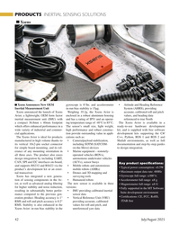
July 2025 - Marine Technology Reporter page: 42Typical power consumption: <0.5W product’s development kit or an exter- mobile robots (AMRs) • Maximum output data rate: 400Hz nal transceiver. • Drones and 3D mapping and • Gyroscope full range: ±300°/s Xsens has integrated a new genera- surveying tools tion of sensing components in the Av- • Humanoid robots
-
 )
July 2025 - Marine Technology Reporter page: 27
)
July 2025 - Marine Technology Reporter page: 27• 18 in source for higher resoluO on can be monitored remotely by an op- PROFILERS erator,” says Crocker. “During towing ApplicaO ons: • 2D & 3D HR + UHR surveys operations, the winch is programmed TRANSDUCERS • Shallow gas hazard with a safe-depth mode: when com- • Geotechnical invesO gaO
-
 )
July 2025 - Marine Technology Reporter page: 5
)
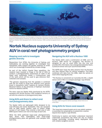
July 2025 - Marine Technology Reporter page: 5University of Auckland, supported by Ink?sh, the University of Sydney’s Seeker AUV, equipped with a Nortek Nucleus 1000, worked alongside divers to create a 3D map of a coral reef off the coast of Tonga. Nortek Nucleus supports University of Sydney AUV in coral reef photogrammetry project Mapping coral reefs
-
 )
May 2025 - Marine Technology Reporter page: 43
)
May 2025 - Marine Technology Reporter page: 43. Visualization of data is possible by integrating advanced georeferenced and gap-? lling module, EXail PHINS with both real-time and historical data 3D photogrammetry, AI-driven analy- C3 Inertial Navigation System (INS), georeferenced in dashboards, maps, and sis, and multiple data types (such as
-
 )
April 2025 - Maritime Reporter and Engineering News page: 43
)
April 2025 - Maritime Reporter and Engineering News page: 43supplied its PowerPack to a pilot project taking place in the sea- Aircraft Carrier Gets AIP for Ammonia-Fueled port of Dordrecht, a project where Van 3D-Printed Valve Manifold Oord, in cooperation with ZEDHub, Ammonia Bunkering Vessel HII’s Newport News Shipbuilding in- Smart Delta Drechtsteden, the
-
 )
March 2025 - Marine Technology Reporter page: 60
)
March 2025 - Marine Technology Reporter page: 60sizes and power rat- The system provides 4K resolution construction of the advanced ROV, the ings to suit trenching in hard ground up video and precise 3D reconstructions, Supporter 6000. to 50MPa. allowing for detailed inspection of un- The Supporter 6000, designed for ul- Trenchers can be con? gured
-
 )
March 2025 - Marine Technology Reporter page: 33
)
March 2025 - Marine Technology Reporter page: 33, Viridien merged and re-imaged image due to its ability to capture a seamless and contiguous volume of a wider range of seismic wave ar- 6,434 km2 of 3D multi-client seismic rivals, including longer offsets, full data in the basin. azimuthal coverage and better low- The data included four separate
-
 )
March 2025 - Marine Technology Reporter page: 31
)
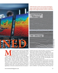
March 2025 - Marine Technology Reporter page: 31framework for imaging legacy seismic data “Every one of these wells provides a direct window into the to enable storage potential to be characterized in 3D. “With subsurface at their location. By reprocessing, collating and the latest seismic processing technologies, legacy seismic data curating this
-
 )
January 2025 - Marine Technology Reporter page: 34
)
January 2025 - Marine Technology Reporter page: 34Linked, a company that was part of the NATO DIANA lytics that enables the IQNS to process data from the forward- accelerator program, has developed a 3D sonar system, 3D-15, looking sonar to detect and classify features in real-time. For that provides imagery in low-visibility environments in real time
-
 )
January 2025 - Marine Technology Reporter page: 33
)
January 2025 - Marine Technology Reporter page: 33while still providing navigational information over six degrees of freedom. Movella launched a new inertial sensor, Xsens Sirius, that delivers real-time 3D data for the precise navigation or sta- bilization of AUVs and ROVs. A key feature is its advanced signal pipeline with analog ? ltering, ensuring
-
 )
January 2025 - Marine Technology Reporter page: 30
)
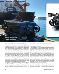
January 2025 - Marine Technology Reporter page: 30, biofouling and structural defects, time sectors, enabling safer, more ef? cient underwater opera- consolidating results into an interactive dashboard with 3D tions across industries, and supporting data collection, infra- models and annotated imagery.” In addition to improving ac- structure inspections, resource
-
 )
February 2025 - Maritime Reporter and Engineering News page: 16
)
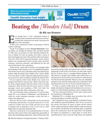
February 2025 - Maritime Reporter and Engineering News page: 16, but technology plays a signi? cant John loves wood, but he is not sentimental about it. He sim- part in the construction. Since the entire hull is 3D modeled, ply knows that wood is better in this application and actually in the frames are laminated to a rough shape on easily devel- many other boatbuildin
