Antarctic
-
- A New Era of Antarctic Exploration: AUVs in Polar Science Marine Technology, Jan 2015 #26
Expeditions in the early 20th century were the first to combine exploration and scientific discovery in the Antarctic. While the Scientific Committee on Antarctic Research (SCAR) was set up to co-ordinate international activities back in 1958, only in the last few decades have we realized the importance of the Antarctic for marine ecology, ocean circulation and climate change. Given its remoteness, the Antarctic is more accessible than ever. The last several years have seen advancements in polar technology and the introduction of autonomous underwater vehicles (AUVs), making previously inaccessible areas open to scientific investigation and hailing the start of a new era for Antarctic exploration.
The Antarctic is one of Earth’s most extreme environments. Ice-winds, active volcanoes, unstable ice-sheets and ever-changing glaciers form the harsh landscape polar scientists must face in order to understand it’s role in ocean circulation, ecological processes and the changing climate. According to the British Antarctic Survey (BAS), it is the largest ice mass on Earth covering an area of around 14 million square km (around 58 times the size of the UK) and holds 90% of the world’s freshwater.
The annual expansion and contraction of sea ice in the Antarctic represents one of the biggest natural changes in the world.
In colder months, sea ice cover can extend more than one and a half times the size of the Antarctic continent (approximately 20 million square km), playing an important role in reflecting solar energy. In the polar summer, the same region might reduce down to 3 million square km and is a major driver of global ocean overturning circulation. In September 2014, sea ice expanded to its greatest coverage since records began in 1978, adding to the ongoing mystery of the Antarctic ice paradox. Additionally, scientists still know very little about the variations in thickness across the continent, making it a considerable focus in research.
Technologies in Extreme Environments
Traditional measurements made by visual observations on board vessels or drilling holes on the sea ice remain vital for polar data collection missions. However, difficulties in getting access to thicker areas of sea ice leaves gaps in the data.
Remote sensing techniques can be used to overcome these issues by providing observations of the physical environment from instruments mounted on aircraft or satellites. While these observations can be useful for measuring large-scale thickness, snow cover can make the process of accurately interpreting the data difficult.
Now, with the rise of Autonomous Underwater Vehicles (AUVs) for polar applications, scientists are able to gain access to remote areas previously inaccessible. The AUVs ability to operate autonomously makes them well-suited to the exploration of extreme environments.
Over the last decade, AUVs have been successfully used worldwide for long ranging, open ocean data collection missions. While they would be useful tools for polar scientists, the use of the technology in these environments come with a number of engineering challenges, financial risks and operational difficulties.
“Recovery in open water is pretty straight forward - if there is a problem, send the vehicle to the surface,” explains Dr. Guy Williams, of the Institute of Marine and Antarctic Studies. “However, under sea ice, returning to the surface is impossible. In addition, unknown bathymetry, icebergs and ocean currents, are all additional hazards that play on the risk versus reward assessment for AUVs in Polar Regions. In addition, the larger AUV deployments tend to dominate the logistics of any voyage they are participating in. When the long range vehicles are in the water, there is often not a lot of other marine science that can occur until it has safely returned.”
Dr. Williams was part of the international team of polar scientists who successfully produced the world’s first detailed, high-resolution 3-D maps of Antarctic sea ice using an AUV developed and operated by the Woods Hole Oceanography Institution (WHOI). While there has been studies mapping ice shelves using AUVs, none before targeting sea-ice. The new technology provided accurate measurements of ice thickness from areas that were previously too difficult to access. The project set the pace of research in the Polar Regions aimed at understanding the dramatic sea ice changes in the context of climate change.
“Previous attempts to estimate the thickness of Antarctic sea ice relied on visual observations and manual drilling - both of which are suspected to be biased to thin ice. The AUV returns the entire thickness distribution for the sea ice floes near the ship - and a richness of data on the morphology of the sea ice in unprecedented detail,” said Dr. Williams.
Operating at 20-30m depth, the AUV was fitted with an upward-looking sonar in order to measure and map the underside of sea ice floes. Lines of data in a lawnmower pattern were merged to form high-resolution 3D bathymetric surveys of the underside of the ice. The combination of airborne measurements of sea-ice surface elevation, ice coring surveys, satellite observations and data from the AUV (called Jaguar), vastly improves scientists’ estimates of ice thickness and total sea ice volume.
The Importance of Internal Collaboration
International collaborations have seen notable funding opportunities for the development of technologies with the objective to significantly progress polar science over the next few years. These technologies are set to provide the resources for data collection beyond past capabilities, paving the way to new discoveries and advanced understandings into the relationship between climate change, the Antarctic and the rest of the world.
In 2014 alone, several partnerships have committed millions for the advancement of Antarctic and Antarctic research. The UK’s Natural Environment Research Council (NERC) has proposed a new ship worth $300 million, containing on board laboratories capable of analysing polar samples from both Antarctic and Antarctic research missions. The latest technology will be available for scientific users, including underwater gliders and robotic submarines. Its robust design outcompetes previous polar research vessels with the ability to advance further through hard ice-covered water and reach areas previously inaccessible by sea.
The Australian Antarctic Gateway Partnership announced $24 million Federal grant, part of which will go into developing a marine technology hub to build next generation hybrid autonomous vehicles for measurements within the polar environment.
Dr. Williams explains, “Our study has laid the foundation for this new funding, as it proved not only the value of the data returned from the AUV, but also that the AUV could be operated in the harsh Antarctic environment without loss - a key concern for funding agencies. While this new initiative won’t directly advance this particular research (WHOI SeaBED under sea ice), it will look to develop the next ‘game-changer’ for even more advanced AUV missions, in particular long-range missions beneath Antarctic ice shelves (much deeper and more challenging).”
The grant is funded by the Australian Research Council (ARC) under its Special Research Initiatives scheme and includes the University of Tasmania’s Institute for Marine and Antarctic Studies (IMAS) and the Australian Maritime College, the CSIRO’s Oceans and Atmosphere Flagship, and the Australian Antarctic Division.
Due to its proximity to Antarctica, Tasmania is an international gateway for both scientific research and logistic support. On some level the different nations are in Antarctica for sovereignty claims, both on land and in the ocean surrounding it. But on a scientific level, Antarctica and the Southern Ocean are critical components of the global climate system. Observational data sets are hard-won and overall there is a paucity of data from this region compared to other parts of the globe.
Dr Alex Forrest from the Australian Maritime College, a Principal Investigator overseeing the team conducting the robotic exploration, explains “Ice is of global significance, playing important roles in ocean circulation and the functioning of polar ecosystems. However, inaccessibility makes it hard to quantify its properties at meaningful spatial scales. AUVs are potentially able to measure horizontal variability in ice properties at near centimetre resolution along kilometers of trackline, offering a fundamentally new approach to ice research. Our project will develop and apply new AUV instrumentation specifically for estimating particularly important and spatially variable properties of ice, that of the irradiance below, and biomass of algae within the ice.”
The collaboration will involve researchers from more than 10 countries and complement the Australia’s Antarctic Science Strategic Plan to understand the role of Antarctica and the Southern Ocean in the global climate system.
The Future of Polar Science with AUVs
The development of polar-adapted technologies will help moderate the associated risks with extreme environmental conditions and reduce the difficulties of accessibility. New technologies will be essential to unlocking opportunities for obtaining new data, surveying unexplored locations and advancing scientific discovery.
Firstly, a number of technical challenges for AUV operations in Polar Regions will need to be addressed, including navigation, data telemetry and autonomy. Navigation and telemetry for AUV platforms relies on satellite positioning (GPS) and communications (Iridium, ARGOS). These approaches are poorly suited to polar areas where ice cover restricts access to the sea surface and adds to the risk of AUV missions. Advancements in data telemetry and navigational systems would mitigate the financial risk associated with the loss of a platform, and more importantly, the scientific data stored on board.
Dr. Williams explains, “Greater endurance or battery life will be the key to expanding the scale of these missions, such that we can make the sort of routine measurements necessary to really get to the heart of questions such as ‘How thick is the entire Antarctic sea ice zone?’ and ‘Is that thickness changing?’. Also, greater sophistication in the autonomy of the vehicles, together with the ability for them to work as teams and also work with autonomous vehicles surveying the sea ice from above (Unmanned Aerial Vehicles or drones).”
While deep waters remain a challenge, shallow high latitude shelves can also be resistant to measurement efforts. Ice scouring poses a serious threat to bottom mounted instrumentation and surveying shallow, ice-covered shelves will likely require a combination of methods and the capability of tolerating instrument losses while still providing useful data return. Nevertheless, surveying shallow or narrow under-ice areas is still an area of scientific interest and a focus for some projects.
Dr Forrest explains “One of the main areas of exploration that we will be targeting is under ice-shelf cavities in the marine setting. While these areas have been visited (probably less than the number fingers on one hand), there is still an amazing amount that is unknown. One of the aims of the Gateway project is to investigate the seafloor, the ice ceiling and the water column in between. While we intend to develop a vehicle that has the conventional technology, we intend to make it modular enough that we can develop new capabilities now and into the future.”
Over the next decade, these new technologies will steer the course of scientific research in the Antarctic. AUVs that are smaller in size and have a higher endurance with effective data telemetry options will eventually be needed to progress observations through the seasons, in areas which have been less accessible until now.
“While working under-ice is ideally suited for robotic exploration, it poses significant environmental challenges that we try to engineer solutions for. Every time we deploy we have unexpected challenges (e.g. Navigation, sensors, etc.). However, what makes a good team is how they respond and overcome these challenges. It is our hope that this platform will be able to provide new insights into marine ecosystem dynamics in the Antarctic but would also be applicable in other ice-covered scenarios,” Dr. Forrest.
The polar environment remains a unique place for scientific discovery and notable advances over the last few years are a result of international collaborations. In the years to come, science in the Antarctic has the potential to lead to major advances in solving vital questions for climate change and ecosystem responses, strengthening predictive models for environmental management and policy reforms.
“Our observations challenge us to explain the world around us and to develop theories that fit these explanations, such that we can predict future behaviour. Any time there is a major advance in our observational capability (new microscope, new telescope, new x-ray machine etc.), there quickly follows dramatic shifts in our understanding/theory and prediction. Measuring is believing and so with so many aspects of the polar environment now accessible by these types of platforms, we can expect a quantum leap forward in our efforts to understand how this vital component of the climate system is responding to change,” Dr. Williams.
Kira Coley is a freelance writer with a Marine Biology degree from University of Portsmouth and experience as a Field Scientist in various locations including Madagascar, Sicily, and Scotland. She is now a PhD researcher and regularly publishes articles and technical papers discussing key research topics in the marine sciences, oceanography and offshore industry.
(As published in the January/February 2015 edition of Marine Technology Reporter - http://www.marinetechnologynews.com/Magazine)
-
- ITT Antarctic Seeks Bids For Charter/Purchase Of Icebreaker For NSF Maritime Reporter, Feb 1989 #26
ITT Antarctic Services, Inc., under contract to the National Science Foundation, Division of Polar Programs, is seeking the charter/purchase of an icebreaking research vessel to operate in the Antarctic and southern ocean waters in support of the U.S. Antarctic Program. The general purpose, multidisci
-
- Keel Laid At Rauma Yard For Soviet Multipurpose Antarctic Research Ship Maritime Reporter, Nov 1986 #8
for delivery to V/0 Sudoimport of Moscow in the fall of 1987. This vessel will serve as an icebreaker, research, supply, and passenger ship in the Antarctic region. During the past few years several countries have shown increasing interest in the Antarctic, and there should be more activity there
-
- SweetWater RO Unit Selected For Antarctic Expedition By British Maritime Reporter, Feb 15, 1985 #42
Peter A. Malcolm, Marine Coordinator of "In the Footsteps of Scott," a British expedition to the Antarctic, has selected the Sweet- Water 400 RO (reverse osmosis) unit as the onboard water supply for this historic, two year voyage. Bob Daniels, president of Marland Environmental Systems, makers of
-
- Wartsila-Powered Multi-Role Research Ship Delivered By Swan Hunter Shipbuilders Maritime Reporter, Nov 1991 #83
in Polar waters, for the transportation of cargo and personnel from the U.K. and South Atlantic ports to research stations maintained by the British Antarctic Survey (BAS), one of the Council's component institutes, in the Antarctic; to discharge cargo without the assistance of normal port facilities
-
- New $40 Million NSF Research Ship Fitted With Thordon Bearings Maritime Reporter, Apr 1991 #84
The R/V Nathaniel B. Palmer, owned by Edison Chouest Offshore, has been custom designed for the Antarctic research activities of the National Science Foundation. Engineered by a firm in Vancouver, and being built in Louisiana, the vessel incorporates both Thordon bearings and a water soluble Thor-Lube
-
- Polar Code Afoot Maritime Reporter, Aug 2014 #18
Casualties • On 23 November 2007, the passenger vessel EXPLORER struck an ice floe in the Bransfield Strait near the South Shetland Islands in the Antarctic Ocean. The hull was breached and the subsequent flooding could not be controlled. The ship sank about 15 hours afterwards. Fortunately, the passenger
-
- U.S.-Built NSF Research Icebreaker Begins Operation Maritime Reporter, Apr 1992 #88
nation's first commercial icebreaking research ship, the Nathaniel B. Palmer, recently began operation for the National Science Foundation (NSF) U.S. Antarctic Program. To be operated under the direction of Antarctic Support Associates (ASA), a joint venture of Holmes & Narver, Services, Inc. (HNSI)
-
- America Needs Icebreakers Maritime Reporter, Nov 2016 #10
thick and able to transit the Northern Sea Route year-round. For several years, the National Science Foundation (NSF), administrators of the U.S. Antarctic Program, chartered a Russian icebreaker each Antarctic summer to support its annual resupply voyages to McMurdo Station, called Operation Deep Freeze
-
- GC Rieber: Carefully Conquering the Extremes Maritime Logistics Professional, Q2 2013 #36
From harvesting Canadian sealskins to breaking through Antarctic Ice, GC Rieber has always been at home in the world’s extreme environments. The business has now diversified into three key segments (ice support, seismic and subsea) and is focused on stability – balancing its ambitions with a conservative
-
- Ice Tech 81 Maritime Reporter, May 1981 #36
Society will be the host. A total of 26 technical papers have been prepared, all dealing with ice navigation and the design of ships for Arctic and Antarctic conditions. The a u t h o rs come from the USSR, Finland, Germany, Japan, Canada and the United States, t h u s , giving a worldwide view of
-
- Wind Power Comes of Age Maritime Reporter, Dec 2001 #8
a leading figure in technical supervision at Chinese yards, a role that has included a series of 19 ships from Zhonghua Hudong. New Capacity for the Antarctic Just as the vessels built for arduous and challenging offshore tasks testify to the maritime industry's capacity for innovation and propensity
-
 )
November 2025 - Maritime Reporter and Engineering News page: 65
)
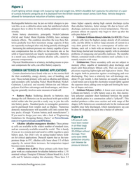
November 2025 - Maritime Reporter and Engineering News page: 65building as it is more active in terms of icebreaking Finnish designers, builders and increases it presence in both the Arctic activity, although the Antarctic is see- machinery and equipment companies and Antarctic. ing elevated scienti? c, data collection hold a dominant position in icebreak- Polar
-
 )
November 2025 - Maritime Reporter and Engineering News page: 58
)
November 2025 - Maritime Reporter and Engineering News page: 58Arctic on Safeguarding U.S. National Interests Arctic Security Cutters (ASCs) abroad. Strategy in 2024, addressing the need to in the Arctic and Antarctic Regions, The memorandum calls for a phased re? ect major geopolitical changes, such which identi? es the need for a “ready, construction plan
-
 )
November 2025 - Maritime Reporter and Engineering News page: 54
)
November 2025 - Maritime Reporter and Engineering News page: 54or counter growing Russian Northern Sea environment of the Arc- on order are delivered, we will begin Route and China’s Polar Silk Road tic, Antarctic, Baltic, the to see older vessels being retired and activity in the Arctic, acknowledges a OGreat Lakes and St. Law- as a consequence net ? eet
-
 )
October 2025 - Maritime Reporter and Engineering News page: 44
)
October 2025 - Maritime Reporter and Engineering News page: 44purposes. than 15 years, according to the company. Due to enter service in 2030, Po- larstern will operate for up to 310 days a year in the Arctic and Antarctic. Built to Ice Class PC2, the vessel will be pow- Marine Fuel Pump Built for Fuel Flexibility ered by two Steerprop SP 160 PULL As shipowners eye
-
 )
September 2025 - Marine Technology Reporter page: 33
)
September 2025 - Marine Technology Reporter page: 33the ice. tions, and tactical deployments. ? ber Optic Cables) Their manufacturing facilities are Key product categories include: On the Endurance22 Antarctic expedi- equipped with extrusion tools, preci- • ROV (Remotely Operated Vehicle) tion, Linden provided a single continu- sion spoolers, pressure
-
 )
August 2025 - Maritime Reporter and Engineering News page: 16
)
August 2025 - Maritime Reporter and Engineering News page: 16. er waters around the world. Since the earliest explorers sought At ? rst glance the Polar Code requirements can seem daunt- to explore the Arctic and Antarctic by ship, many vessels have ing and confusing, however a deeper dive into the require- been lost due to sea ice, cold air temperatures and ice accretion
-
 )
July 2025 - Marine Technology Reporter page: 35
)
July 2025 - Marine Technology Reporter page: 35¯ Australian Antarctic Program ¯ RSV Nuyina Completes Voyage for the Australian Antarctic Program The RSV Nuyina, operated by Serco, has returned safely to Hobart after a 9-week dedicated marine science voyage to the Denman Glacier, carrying 85 Australian Antarctic Pro- gram expeditioners and 45 crew.
-
 )
January 2025 - Marine Technology Reporter page: 17
)
January 2025 - Marine Technology Reporter page: 17the atmosphere and surface waters become cooler and denser. the densest and deepest waters of the global ocean are formed. Sea ice cover around Antarctica hit a record low in 2023, “However, this cooling and subsequent sinking of waters with ice reductions in strong loss regions 50 to 80 % below
-
 )
January 2025 - Marine Technology Reporter page: 16
)
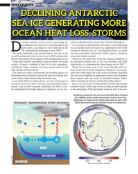
January 2025 - Marine Technology Reporter page: 16DISCOVERY NOC DECLINING ANTARCTIC SEA ICE GENERATING MORE OCEAN HEAT LOSS, STORMS Courtesy Dr. Andrew Meijers eclining Antarctic sea ice cover is generating un- which could ultimately extend to the Northern Hemisphere. precedented ocean heat loss to the atmosphere and “It is too early to state whether
-
 )
March 2024 - Marine Technology Reporter page: 35
)
March 2024 - Marine Technology Reporter page: 35Figure 1 A self-righting vehicle design with buoyancy high and weight low, WHOI’s SeaBED AUV captures the attention of a pair of curious Antarctic penguins as it is deployed from the British research vessel James Clark Ross. Vehicle designers allowed for temperature reduction of battery capacity. Recharge
-
 )
March 2024 - Marine Technology Reporter page: 15
)
March 2024 - Marine Technology Reporter page: 15Martin. He simultaneously for months at a time, extending deployments earned his Bachelor of Science in Electrical even in remote locations like the Antarctic. Engineering and Mechatronics at Villanova And for users who tend to operate in areas with drastic University and a Master of Engineering changes
-
 )
November 2023 - Maritime Reporter and Engineering News page: 48
)
November 2023 - Maritime Reporter and Engineering News page: 48that developed the vessel. to build a new icebreaking vessel for the supply of its 13 to 2.5-meter-thick multiyear ice, and astern in more severe ice Antarctic stations. In addition, Aker Arctic has helped to de- conditions such as heavy ice ridges. velop an ice-strengthened propulsion line for the new Po- hjanma
-
 )
September 2023 - Marine Technology Reporter page: 46
)
September 2023 - Marine Technology Reporter page: 46opera- Saildrone USVs have already sailed nearly 1,000,000 nauti- tions, including high-resolution MBES and Innomar SBP cal miles from the Arctic to the Antarctic, spending some systems, and can deliver long-duration IHO-compliant mul- 25,000 days at sea. Saildrone’s masthead 360° optical cam- tibeam mapping
-
 )
January 2023 - Marine Technology Reporter page: 42
)
January 2023 - Marine Technology Reporter page: 42and the naval What are the Scienti? c Objectives? completing the preliminary design stud- engineering of? ce Ship-ST who have Little is known about the Antarctic ies with the French marine engineering accompanied me on this bold project. Ocean due to its size, proximity and ? rm, Ship-ST, to verify the
-
 )
September 2022 - Marine Technology Reporter page: 71
)
September 2022 - Marine Technology Reporter page: 71Kevin Hardy Ocean Appliances, Australia Kevin Hardy tanic’s head-on collision with that iceberg, or a USAF C-130 Figure 13 cargo plane landing on an Antarctic ice sheet. Featuring the fastest release of any release system, As a result, ice makes an easy, cheap, and strong release ca- DesertStar’s ACR-1
-
 )
September 2022 - Marine Technology Reporter page: 41
)
September 2022 - Marine Technology Reporter page: 41has supported two major research proj- ects in remote locations. In March, digital content agency Lit- tle Dot Studios broadcast the discovery of Antarctic explorer Sir Ernest Shackleton’s lost ship, Endurance, from 3,000 me- ecosystem for future generations. In what is Inmarsat’s second tres below
-
 )
June 2022 - Marine News page: 33
)
June 2022 - Marine News page: 33are emerging, and she referenced “synthetic aperture radar (which) can be used to detect dark vessels at sea, monitor ice ? ows in the Arctic/Antarctic, and see through clouds even during hurricanes. Radio Frequency (RF) mapping from space 33 www.marinelink.com MN
-
 )
November 2021 - Maritime Reporter and Engineering News page: 71
)
November 2021 - Maritime Reporter and Engineering News page: 71by LT successful expedition, in 1933-1935, was put into service by the U.S. Navy as Ellsworth Berthoff and ship’s surgeon and later for the U.S. Antarctic Expedi- part of the rescue ? eet for the Greely Ex- Dr. Samuel Call, from Nelson Island tion of 1939-1941. During World War pedition to the Arctic
-
 )
September 2021 - Marine Technology Reporter page: 67
)
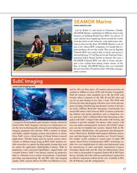
September 2021 - Marine Technology Reporter page: 672006 has been in the business of building World Class ROVs for almost 15 years and has been supplying clients around the world, from the Arctic to the Antarctic, with underwater solu- tions to discover the deep. SEAMOR Marine is one of just a few subsea ROV companies in Canada that ex- ports products all
-
 )
September 2021 - Marine Technology Reporter page: 62
)
September 2021 - Marine Technology Reporter page: 62deeper insight into the vast mid-ocean region known as the twilight zone. © Evan Kovacs/©Woods Hole Oceanographic Institution In the kelp forests of Antarctica’s Ross Sea, underwater Dalhousie University, the University of New Brunswick ROVs are playing a role in ecosystem health assessment, too. and
-
 )
November 2020 - Marine Technology Reporter page: 37
)
November 2020 - Marine Technology Reporter page: 37can travel faster deploying such a system in high lati- conference last year. “AutoNaut can sit (up to 3 knots) to an area of interest to tudes; the Antarctic, for example? The and wait for a Tsunami, an eruption or deploy a SeaGlider, gather surface data Universities of East Anglia (UEA) and spring
-
 )
October 2020 - Marine News page: 14
)
October 2020 - Marine News page: 14and extensive experience in mission is to maintain defense readiness in the Arctic and reducing lifecycle operating costs through optimal design. Antarctic regions; enforce treaties and other laws needed to Halter Marine is known worldwide for our capability safeguard both industry and the environment
-
 )
October 2020 - Marine Technology Reporter page: 61
)
October 2020 - Marine Technology Reporter page: 61to complete the global mapping of the disciplinary scienti? c research in control of the data from various ‘work- ocean ? oors in the next 10 years. Antarctica, and each season sends around 300-plus research and support staff to the continent. It operates three research stations in the Antarctic and
-
 )
October 2020 - Marine Technology Reporter page: 59
)
October 2020 - Marine Technology Reporter page: 59Data, eveloped a motion since the 80s, undertaking several for the MUM system. Each vehicle carries new slickline deployed high ? eld trips to the Antarctic and performing a built-in streamlined EvoLogics USBL expansion retainer for cement numerous wind tunnel and water tank modem for underwater data