C-Map's RTU and the Ending of the Paper Trail
The introduction of the electronic chart is a major step forward in improving the safety of navigation at sea, as it save mariners time and effort and improves safety, and offers optimized functionality. ENCs (Electronic Navigational Charts), issued by Hydrographic Offices, are now recognized as charts as defined by SOLAS, provided they are displayed on a type approved ECDIS (Electronic Chart Display Information System) and are kept updated.
It is the responsibility of National Hydrographic Offices to produce ENCs.
Production of ENCs has proved more difficult than anticipated and to date nominally 15 percent coverage exists. The g a p s c a n be filled in with c o m m e r c i a l vector electronic charts which although functionally similar to ENCs are not recognized by the IMO as equivalent to paper charts. Nevertheless they permit seamless electronic chart navigation, albeit in conjunction with the paper chart where ENC coverage is not available. C-MAP supplies production and quality tools to Hydrographic Offices for the production of ENCs. It also carries out subcontract work on behalf of a number of Hydrographic Offices. It is anticipated that both of these activities will accelerate the production and availability of ENCs.
The original concept put forward by the International Hydrographic Office for a series of Regional Electronic Chart Centers to distribute ENCs has proved difficult to implement. C-MAP has implemented a strategy based upon working with HOs and entered into dis- tribution and licensing agreements with them. Having adopted this strategy CMAP is able to offer a worldwide database of electronic charts together with a distribution, licensing and updating infrastructure. ENCs and commercial electronic charts may be updated by means of CDs or floppy discs, but delivery of these is subject to similar delays to those that apply to paper NMs and they can arrive in batches and several weeks could have elapsed from the time when the update was originally issued to it being available for the ships officer to bring his charts up to date.
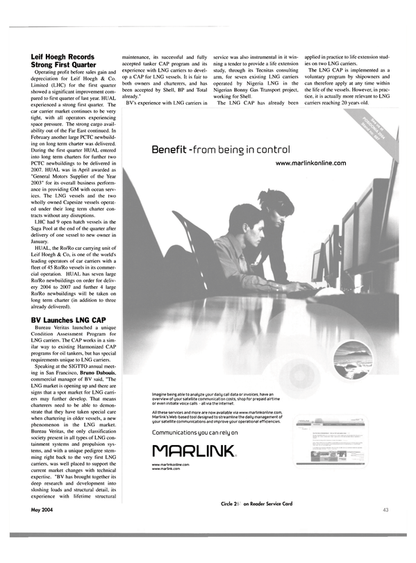
The obvious solution is to correct electronic charts automatically via satellite communication, telephone or landline.
but the cost factor has prohibited many ship owners and managers from adopting this methodology. C-MAP's solution is Real Time Updating Service (RTU), as files are compressed to 17 percent of their original size and competitive satellite rates are available through service providers.
Circle 3 on Reader Service Card
Read C-Map's RTU and the Ending of the Paper Trail in Pdf, Flash or Html5 edition of May 2004 Maritime Reporter
Other stories from May 2004 issue
Content
- Fincantieri Delivers Westerdam page: 10
- "World's Largest" Heavy Lift Ship Enters Service page: 10
- Damen Delivers Pair of Tugs page: 10
- Not Just Another Dam Ship page: 12
- Welsh Towing Company Growth Continues page: 14
- Gladding-Hearn Starts Construction of New I neat Vessel page: 15
- Despite 11% Increase, Hempel Disappoints page: 15
- Grimaldi-Naples Receives GM Award page: 16
- Schlueter Promoted to VP page: 17
- Misplacing the Place of Refuge page: 20
- Schottel Broadens Electric Propulsion Options page: 26
- CIMAC Congress Set for Kyoto page: 29
- Waterjets for a Difficult Design Task page: 30
- New Shaft Seal from Ocean Venture Seals page: 31
- Gas Turbines: Keeping Fresh With Innovation page: 32
- MAN B&W Diesel Debuts the New S65ME-C page: 33
- Thordon COMPAC Finds Success in FSV page: 33
- Wartsila to Power Australian FPSO page: 34
- VSP: Same Power, 9% More Bollard Pull page: 35
- The New MTU 2000 CR Marine Engines page: 36
- Converting and Repowering One Very Big Ship page: 38
- Power for a New Breed of RoPax page: 40
- ZF Helps to Harness Spirit of Ontario's Power page: 41
- Greece Poised for Posidonia 2004 page: 42
- Leif Hoegh Records Strong First Quarter page: 43
- BV Launches LNG CAP page: 43
- Steel, Ship Prices Soar as Tankers Stay Firm page: 44
- Ice Class & Large Ships Pose New Challenges page: 44
- Royal Caribbean Stays Current with C-MAP CM-93/3 ECs page: 46
- JRC Proposes Integrated Nautical Safety System page: 46
- C-Map's RTU and the Ending of the Paper Trail page: 47
- AutoChief C20 Reports Good Market Penetration page: 48
- Vision FT IBS page: 48
- Research Winches for R/V Maria S. Merian page: 52
- Konecranes Giving Port Efficiency a Lift page: 52
- Chinese Yard Logs Strong Month page: 55
- Fuel Oil Separation Takes Center Stage page: 56
- Security of Ports and Vessels: A New Approach page: 60
